Mount Pugh Recently Claimed Another Hiker
I've pretty troubled by the news that, this past weekend, a hiker fell during a hike on one of my regulars (Mount Pugh) and died. This news has been troubling me for many days now, as I hike a lot, and also trail run, and so I've experienced a lot of highly varied conditions, from heavy snow (and traversing avalanche chutes), to torrential rains, to a sudden fog bank rolling in resulting in near-zero visibility at a very high elevation[1]. And so this story really resonates with me, in terms of how troubling it is.
Here are some thoughts, in no particular order, on hiking Mount Pugh (and points beyond):
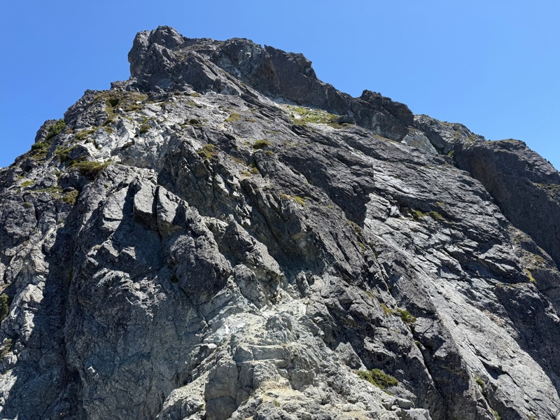
- ”Mount Pugh is known as a challenging, ‘very skilled‘
level hike (often cited in the context of expert, not beginning, hikers)
with steep, rocky terrain and significant exposure near the top, making
it a dangerous area in the Cascades[2]“.
(Read: it's a serious hike.) - It's one of the only mountains that I had to make multiple attempts to summit before I was successful. I needed some progressively-further warm-up hikes to convince myself I could do it. My 2018 hike ended, voluntarily, approximately 0.33 miles past Stujack Pass[3] because I didn't think I was prepared to summit[4] .
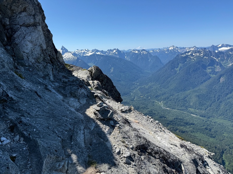
- Every time I hike it I [literally] say the same thing on the exposed razor edge section: "Why is this legal?". That's where the 800' drop-offs are, to the south.
- I've summited Mt Pugh each year from 2021-2025.
In 2021, I actually made it to Stukjack Pass and turned around because it was raining
(and very overcast / visibility was near zero). The idea of proceeding past Stujack
that day was absurd. It's way too exposed up there, and when rocks are wet, they can
be very slippery (I came back a week later and summited when it was dry and sunny).
I posted four photos of Stujack from that day below. - There's a particularly dangerous section where the "trail" (which is on exposed rocks) switches back to the left, but if you're not paying super close attention, you can easily miss the turn and continue straight. And if you do so, you're essentially just walking onto a narrower and narrower (and thus more exposed) surface, which is solid rock. To your right is a ~800' drop, nearly straight down.
- I also spoke with SCV SAR
(Snohomish County Volunteer Search and Rescue) and they mentioned that
another big problem is that people sometimes come down on the
wrong side of the glacier field, and it's so steep and unforgiving
that they effectively end up stranded and have to be rescued.
They said it was a case of not having enough energy to re-summit the east ridge to come down on the correct side, as well as people believing they are "cliffed-out" (they cannot go back/up, nor can they continue down). - I have been up there in the snow and during that hike, I deployed upwards of 75-100 trail markers along the way, to make sure I wouldn't get turned around. The trail disappeared under large snowfields, and so it was tricky to follow in spots. It was also tricky to walk next to 8' of snow (a wall of snow taller than you, and the gap between myself and wall of rock was only a couple of feet).
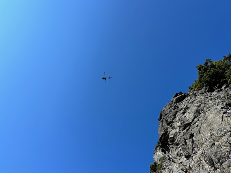
- I've been up near the summit when SVC SAR was circling the mountain over and over and over (this was ~3 years ago). It was a weird feeling to be up there knowing they might have been looking for someone. It was very disconcerting.
- The same weekend someone died on Mt Pugh, someone also died on Mt Si. Every few years, Del Campo Peak (another one of my regulars) claims a hiker.
I'm very sad for this hiker and his friends and family. His name was Alex Keen. He was only 34[5].
I've been a huge supporter of SCVSAR over the past few years, and I promise to make a donation in Alex's name. While I was out hiking this past weekend, seemingly everyone I knew had heard about the hiker who passed away on Mount Pugh. My hope is that every single one of those hikers is just a bit more careful moving forward: "For I do not know the day, nor the hour..."
I've had two very terrifying experiences hiking, as in: existentially terrifying. These were:
- Del Campo Peak: at the summit, just before beginning my descent, I became disoriented, and I got momentary vertigo + target fixation + anxiety attack and I nearly pitched forward from the summit down a straight drop-off.
- Mount Pilchuck: I got lost: very, very lost, and ran out of water, and the forecast was for temps upwards of ~106° that day. I ended up in a very remote area and could no longer go down, nor go east, nor west (due to the terrain). It was really scary.
Both experiences changed me, fundamentally in terms of how I prepare for hiking (and trail running), as well as how I actually hike. Mount Pugh has also been a great teacher, and I think I learn something[6] every time I'm on that mountain.
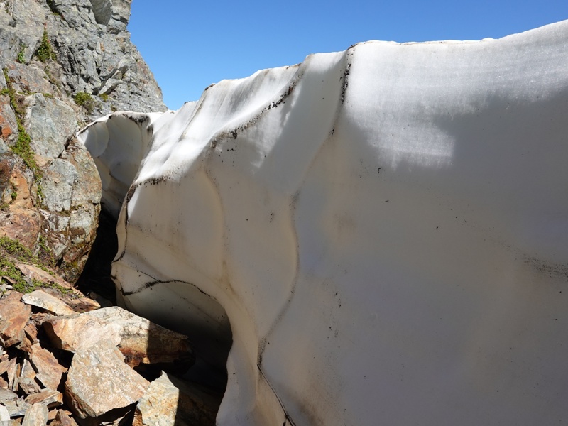
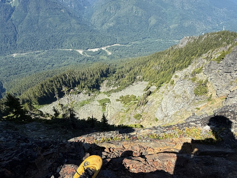
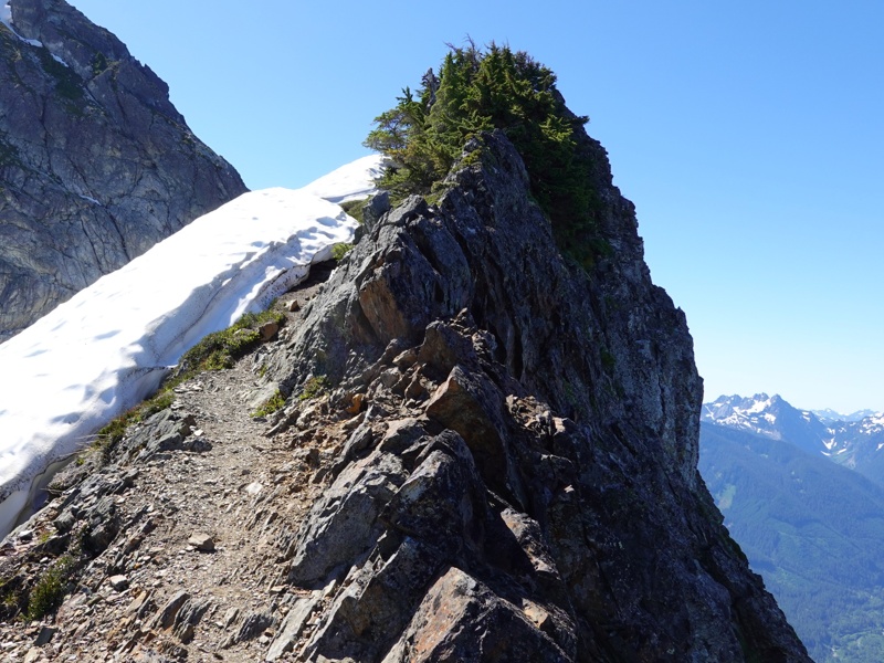
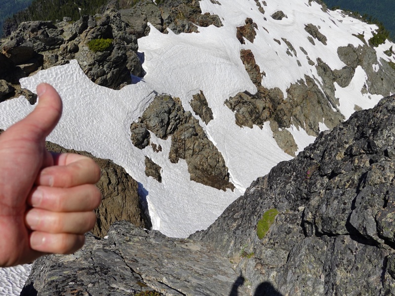
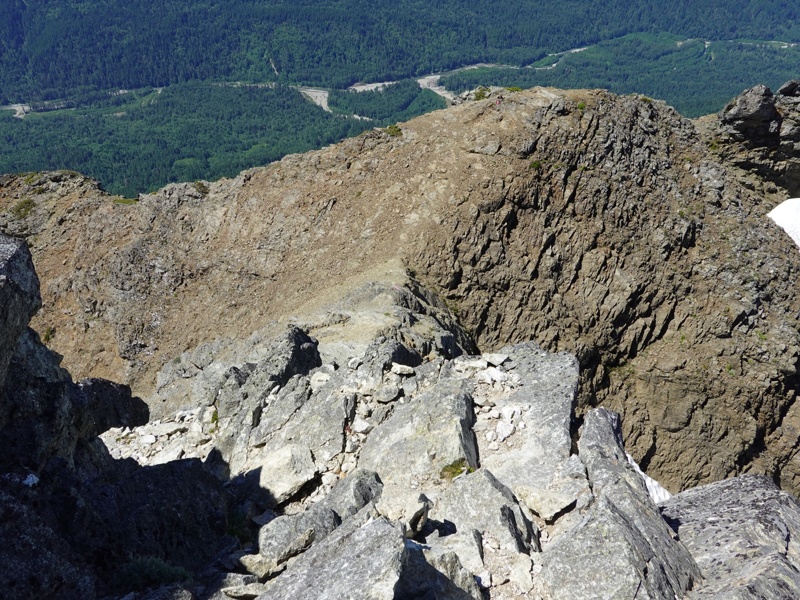
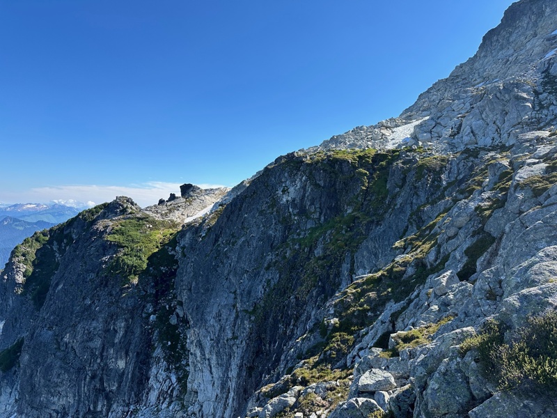
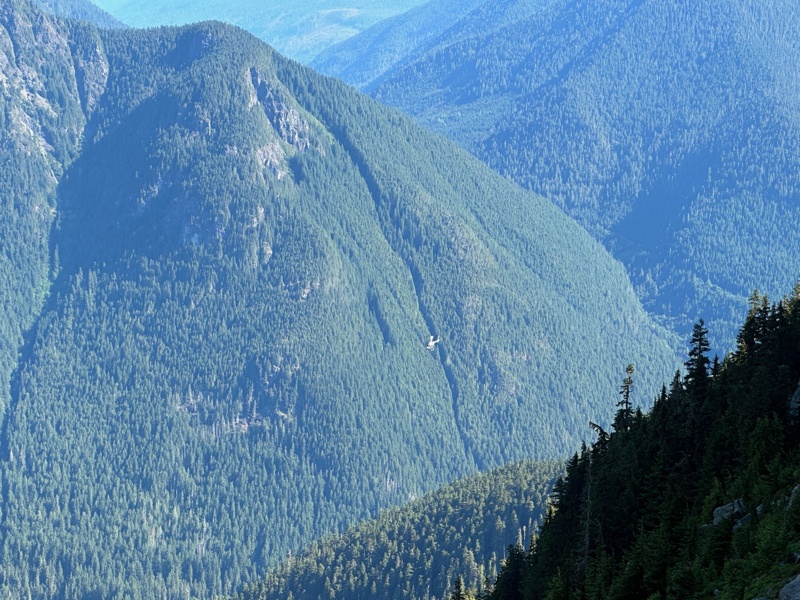
I'd like to think of this as a time to meditate on hiking, safety, and to re-awaken my consciousness as to just how dangerous this mountain is, as I am sure to attempt to summit it again. To that end, here are four photos of my 2021 failed attempt to summit. In my defense, it was a lot less foggy at lower elevation. The problem should be readily apparent here: it's a narrow, rocky trail in several sections, and it's entirely on smooth rock in places.
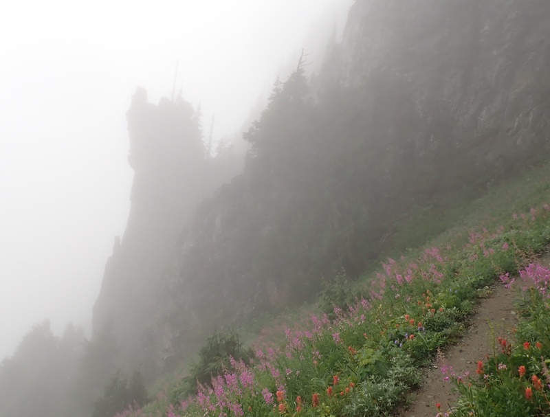
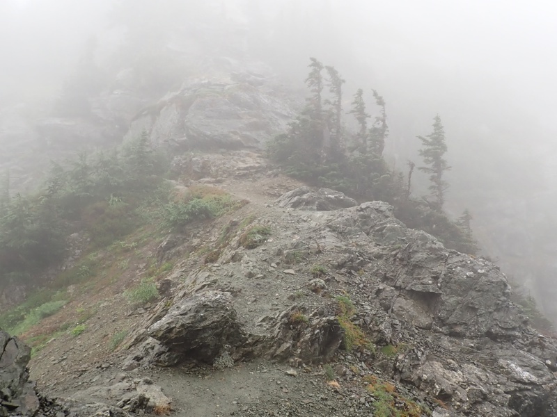
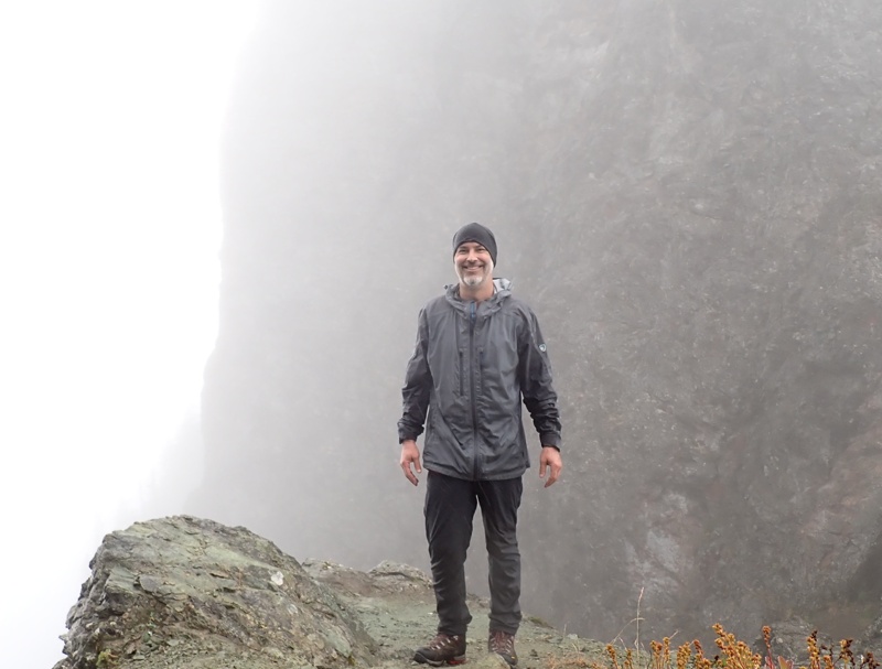
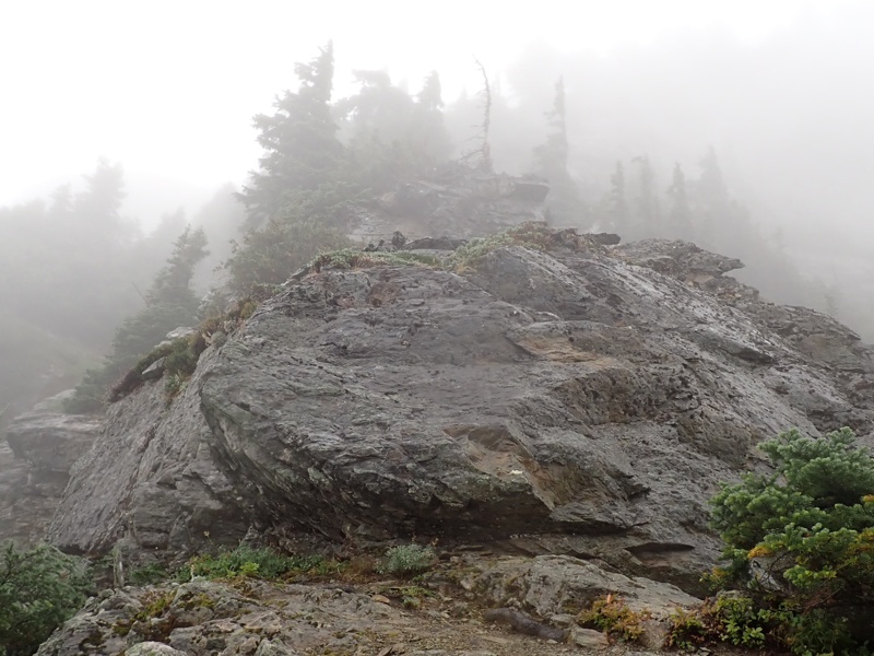
Here are some photos (all from Mount Pugh hikes) of things I mentioned when describing previous hikes to the summit. I tried to add depth perspective to the steep drop-off sections using my foot or hand. I also tried to find photos that show specific parts of the trail I mentioned earlier.
"Use your hands to continue scrambling, passing an iron ring protruding out of the rock."
The iron ring was essentially where I stopped.
FOR IMMEDIATE RELEASE: May 12, 2026
DARRINGTON, Wash. – The Snohomish County Sheriff’s Office has concluded the search for a missing 34-year-old Bothell man, after he was located deceased on Mt. Pugh. The Bothell man was reported missing on Sunday, May, 10 after he failed to show up for work. The initial information gathered by deputies lead them to believe he had been hiking alone near Mt. Pugh, which is outside of Darrington. A Search and Rescue Deputy located the hiker’s vehicle at the Mt. Pugh trailhead. This immediately began a multi-day search operation utilizing volunteer personnel from Snohomish County Volunteer Search and Rescue, Everett Mountain Rescue, Skagit Mountain Rescue, Tacoma Mountain Rescue, Olympic Mountain Rescue, and Seattle Mountain Rescue Units. During the initial search, in the first 12 hours, other hikers coming down the trail provided clues to searchers, providing a possible last known location. Through a coordinated effort between mountain rescue units and two Sheriff’s Office helicopters, personal hiking equipment was located at the top of a steep couloir. On the third day of search operations mountain rescue teams were inserted via helicopter and were able to work down the couloir where they located the male deceased, 800 vertical feet from where the initial personal hiking equipment was located. The male was recovered from the mountain via the Sheriff’s Office helicopter, SnoHawk10. The decedent was transported back to Taylor’s Landing via helicopter and turned over to the Snohomish County Medical Examiner’s Office. Positive identification, as well as cause and manner of death will be determined by the Snohomish County Medical Examiner’s Office.
- I read recent trip reports. These can be gold, in terms of specific challenges you might encounter (like snowfields).
- I have 3-4 GPX maps on my phone, and consult them if they might help. It's tricky up there, those maps aren't always helpful (thus the trailmarkers note below), but they can help for sure.
- If I'm hiking anywhere where I don't have a GPX track (e.g.: on snow, when the a bootpath deviates from the traditional trail), I log my GPS positions of my hike using GaiaGPS.
- I have redundant map applications on my phone: GaiaGPS and Avenza Maps. Both are good at what they do, but sometimes I find the incredible simplicity of Avenza to be more comprehensible when I'm in a jam (e.g.: off-trail and needing to get back on).
- There are no water sources after Lake Metan, so I cache some water along the way (at the base of the talus slope leading to Stujack, and also at Stujack Pass). That way, I don't have to carry a ton of water in the last ~0.75 miles, and neither do I have to worry about water (ever).
- I always bring several dozen trail markers. I tie these
around rocks on the trail to mark my ascent, particularly
when it's a little tricky to navigate. I use them
frequently when there's snow to show entry/exit points
of the trail into/out of the snowfield.
Oftentimes, I'm convinced the markers are just to calm my mind when I'm on my descent. Seeing one is [literally] always a welcome sight. It lowers anxiety. - I'm slow, and careful, after the razor-edge section. I'm low to the ground on the scrambles. I'm leaning into the wall on the exposed sections.
- I often stop/pause in the difficult sections to survey. I think it helps a lot to get both a topographical / terrain-based understanding of what you're getting yourself into.
- I look ahead on the trail. I need to know where I'm going as far as I'm able to see. You always want to know (a) where you're going in the next ten steps and (b) where you're going in the next couple hundred steps.
- I carry an Iridium (satellite phone).
- I wear bright orange, so SAR can find me if I fall.
- I bring sun protection. You're in the sun a lot up there.
- I bring an extra battery and some charging cables for my phone and the Iridium device.
- I bring more layers than I need, particularly a very warm hat. It's not too much weight to do so, and could help me if I had to spend the night up there.
- I start wicked early, so I'm down by mid-afternoon.
- If it's wet or there's too much snow or very poor visibility, I turn back.