A Layman's Guido To Summiting Del Campo
(And Under Adverse Conditions Nonetheless)
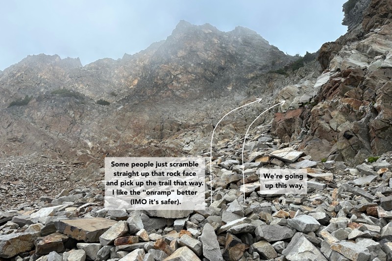
I've attempted to summit Del Campo twice previously. On the first attempt I got lost and had to enlist the help of two speed boulderers who were kind enough to let me join them on their way to the summit. On the second attempt I made it to the base of the peak's crags but couldn't find the scramble onramp[1].
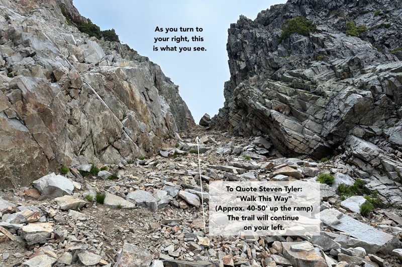
Since the ingress to the scramble is non-trivial to locate, I'd like to attempt to provide a guide, to make it a little clearer.
NOTE: There are photos from yesterday's hike. Start on page 9 for non-mobile and on page 25 for mobile.
I think I'd like start at the end (the summit), in case you get bored, distracted, and/or irritated and don't read anything past this section. I learned quite a bit about how to navigate a peak like Del Campo under very low-visibility conditions, and I think my observations will prove to be very valuable to others:
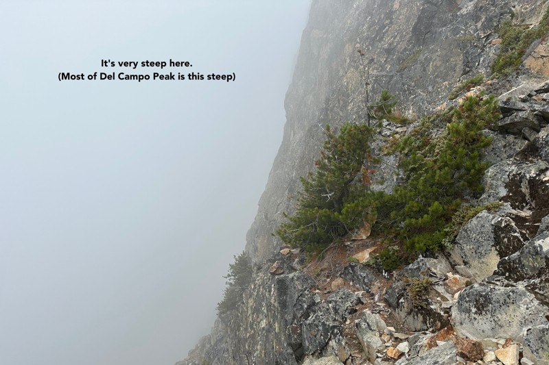
- Del Campo Peak is incredibly dangerous. To quote
wta.org:
"Should you decide to tackle the summit, know that it is incredibly
steep, and a fatal fall is never more than a misstep away."
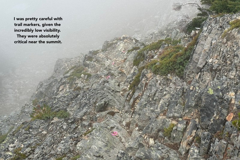
This is quite true. I saw for myself where those "fatal fall missteps" are likely to occur. The take-away here is that the vast majority of that scramble to the summit is along sections that, if you fell, you might lose your life.
Another takeaway, from my previous (unorthodox) summit of Del Campo, is that it's sufficiently steep that there may be only one viable (read: sane) route to the top. My highly skilled [and ambitious] speed-boulders tried to find an alternate path and were unable to do so[2]. - To summit (particularly under low-visibility conditions), it's a requisite that you carefully
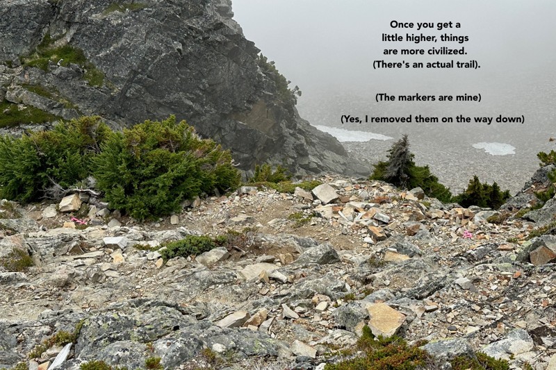
mark your ascent route on the scramble section. The problem being: as far
as I can tell, there's only one route to the summit (and therefore
only one route down), and if you attempt to proceed down the wrong
route from the summit, you'll inevitably be "cliffed out"[3].
When I was at the summit, the fog was so thick I had a really hard time using any landmarks at all to guide me down. Normally, I'm pretty sure you can "look down at the direction you'd like to go" and begin your descent, but that doesn't work when you can't see anything.
The other problem being, as far as I can tell, of the 360° you can observe at the summit, the descent route falls along approximately 5° of it, so you need to know where you're going (rather precisely it seems). - Another requisite is to load up 2-4 GPS routes from hikers who have previously
summited, and put those on your phone (and then display them on the main map
of your hiking app). I used GAIA GPS for this purpose, and loaded two maps from
peakbagger.com.
These maps saved my bacon at the summit, as I'll explain later.
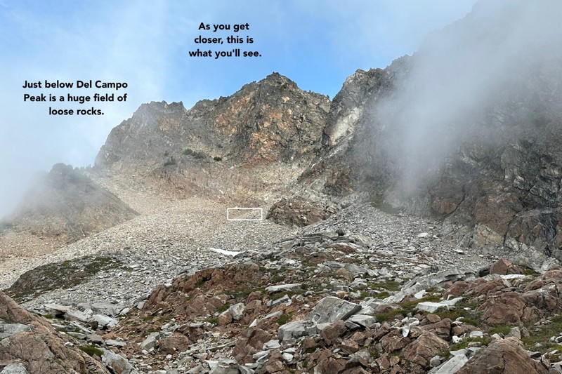
GPS data can be very wacky along steep sections, and having 2-5 routes on display will work in your favor. Places they converge are usually right on the trail itself. Places they diverge can still be useful, just to give you a sense of direction. - Wear a helmet. There's a lot of loose rock on that peak, and other hikers will, through no fault of their own, likely dislodge some of it. Additionally, other hikers may be [literally] right above you, and so rockfall is always a potential problem. It's also pretty easy to slip and fall on the loose rocks that make up the boulder field you need to cross to get to the scramble route.
Here's a quick overview of my hike, as it overwhelmingly informs my subsequent guide.
When I set out, things were looking pretty good, weather-wise. The forecast called for "morning clouds, clearing in the early afternoon", and while I drove through rain showers on my way to the Barlow Pass trailhead, it was clear when when I got to Foggy Lake.
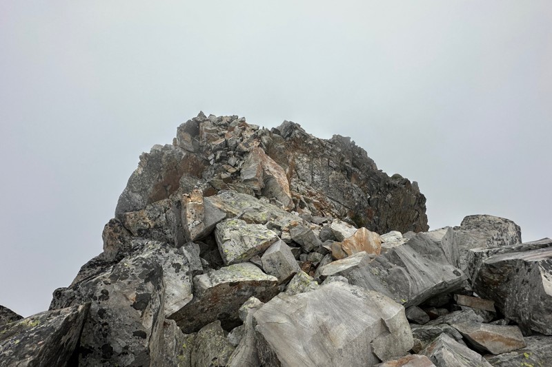
This was what Del Campo Peak looked like at 9:40am on 8/07/23:
My ascent to Gothic Basin was super fast (as was the extension to Foggy Lake), but my time from Foggy Lake to the summit was 1 hour, 50 minutes, which is incredibly slow.
Before I get too far, here are a couple of stats:
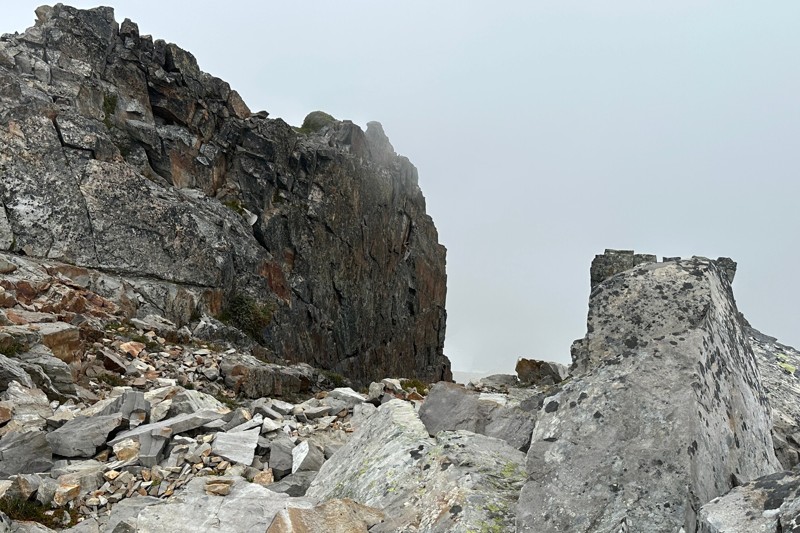
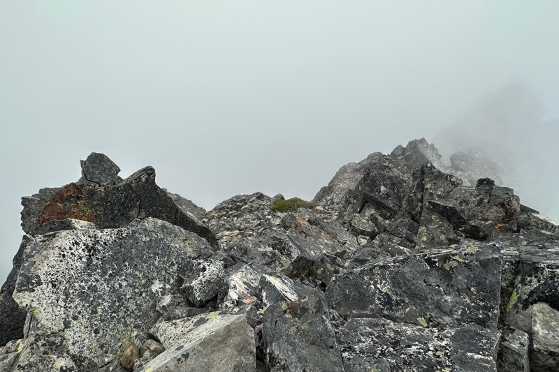
I don't recall where most of that time was spent, but I'm fairly certain a lot of it was spent (a) approaching the scramble route and then (b) on the scramble to the summit itself. As I approached the peak, very thick fog rolled in, and my visibility was quite poor. I'm sure this caused me to proceed with ample caution.
Del Campo is rated by WTA.org as a "Class 3 Scramble"[4], which means (among other things) "Sustained hands-on scrambling, with decent exposure".
By the time I got to the top, around 11:30am, this is what the summit looked like:
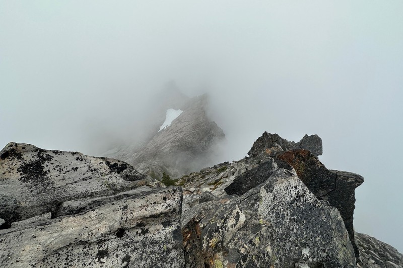
Visibility was incredibly poor, and I was concerned that it might begin to rain.
Since this hike was mainly for "exploratory purposes" (aka: find the scramble, get on up there), as well as for me to face my fears about summiting this particular mountain[5], I didn't care if it was cloudy or not... this one was all about the journey.
My descent got off to a rough start. As you can see on that map, there's much wandering around at the very beginning. As it turns out, I was a few degrees off in terms of the direction I thought I needed to go to begin my descent, and all I saw were steep cliffs everywhere.
I had to re-summit, multiple-times (and calm myself down before I could proceed, as I was a little panicked), but I was able to use GPS data in (IMO) the only useful way I've really ever used it:
When I'm off-trail, as I was at the start of my descent, I pull up the map and orient my phone so it's pointing perpendicularly at the nearest section of the trail .. that way, I know which direction I need to walk (and in the shortest distance), to re-find the trail.
This is what I did at the summit and it worked. I climbed down the huge stack of boulders that makes up the summit and saw a couple of my trail-markers. To say I was happy at that moment doesn't even begin to describe how relieved I felt.
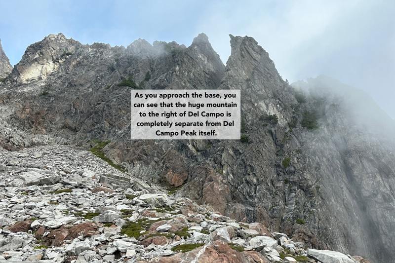
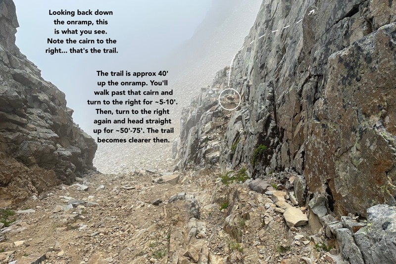
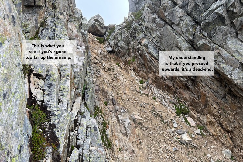
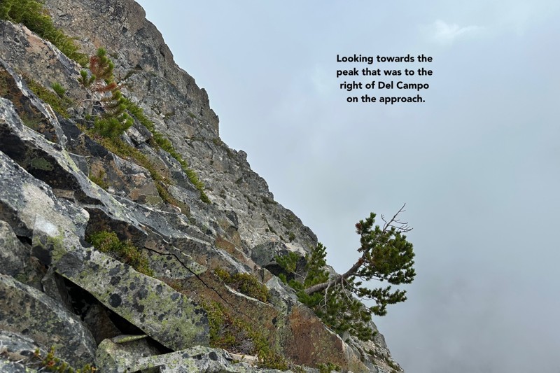
As promised, here is my guide. I focused almost entirely on "getting yourself onto Del Campo Peak", as it's relatively straight-forward after that (although the last section near the summit itself is wicked steep and you should be careful up there).
Click each photo to get a hi-rez version:
- "Sustained hands-on scrambling, with decent exposure"
- "Moderate scrambling on steep, rocky terrain that requires handholds for upward movement and safety."
- "These should only be tackled by experienced scramblers with rope skills and they will also require route finding experience. Generally escape routes are difficult and may require abseiling knowledge and it can be easy to stray onto difficult rock climbing territory if you come off the route."
- "Hands-on scrambling with moderately difficult moves. A fall will break a bone."