Mount Pilchuck Photos: Annotated
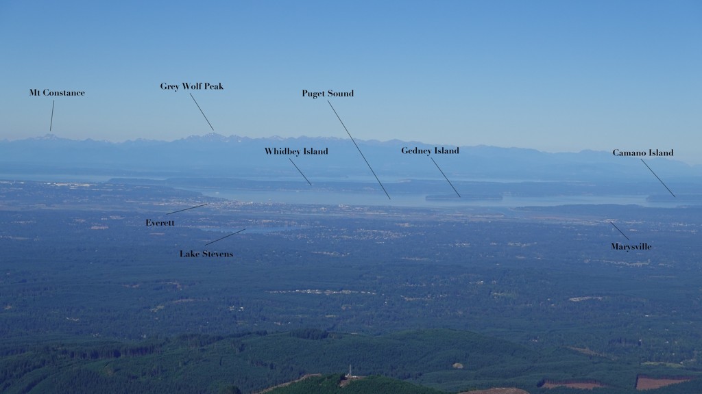
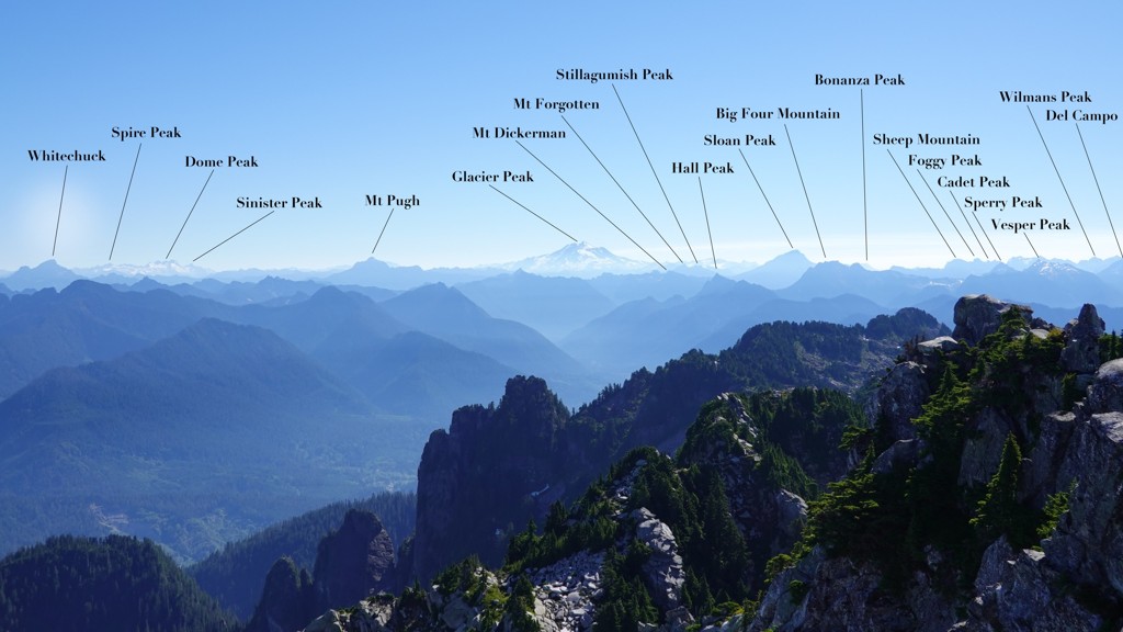
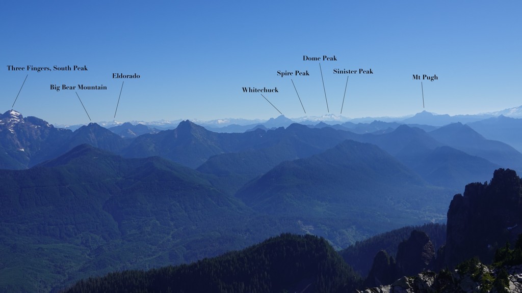
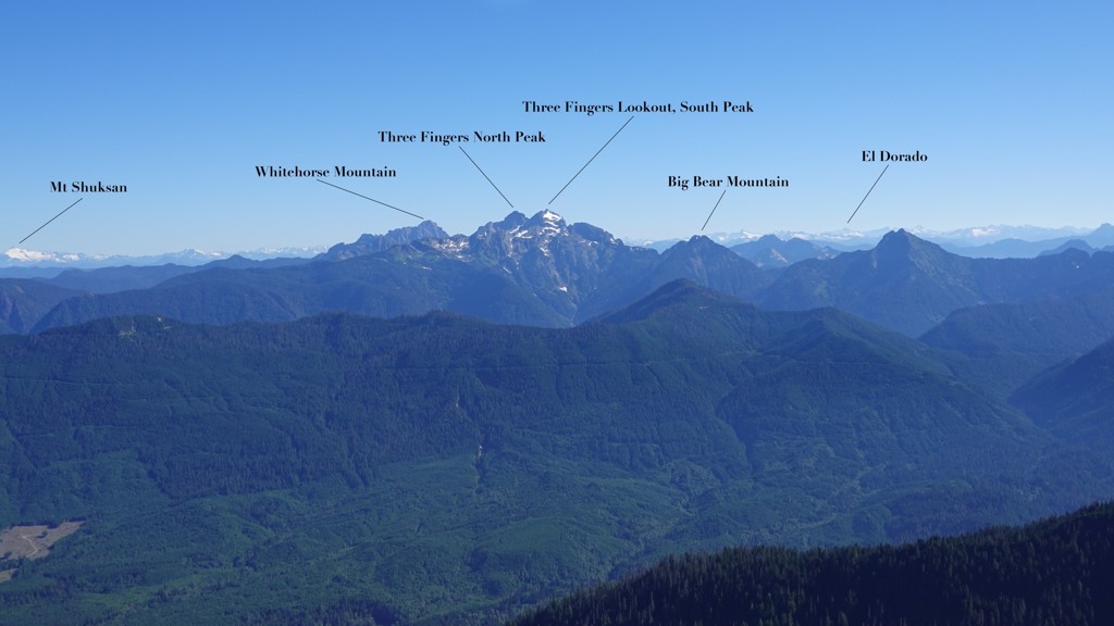
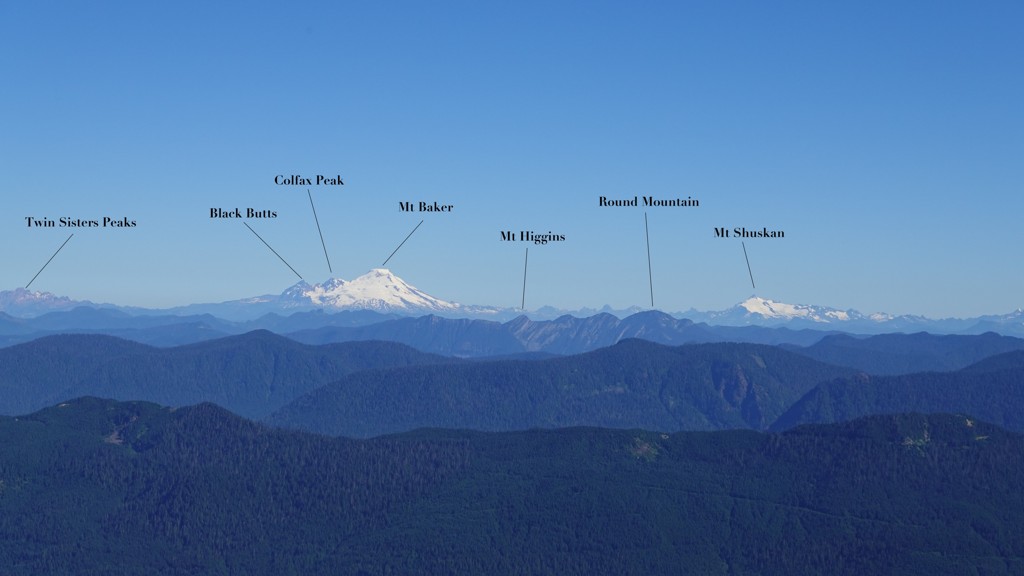
At the summit of Mount Pilchuck is a fire lookout, and inside of the lookout is a set of placards that help hikers to identify key landmarks in the surroundings. On a clear day, visibility is over 100 miles (and can be as high as 150 miles if you're really lucky).
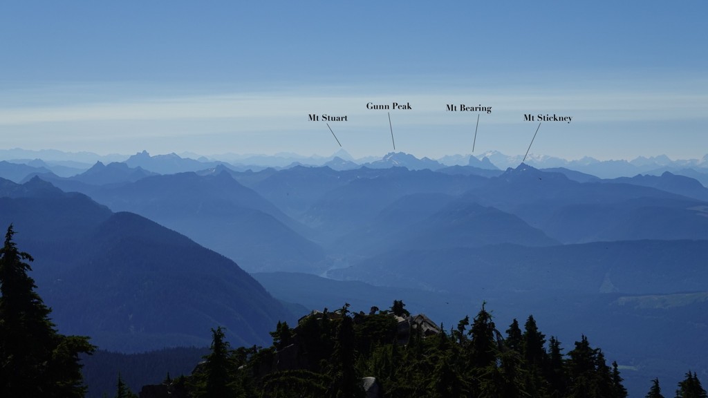
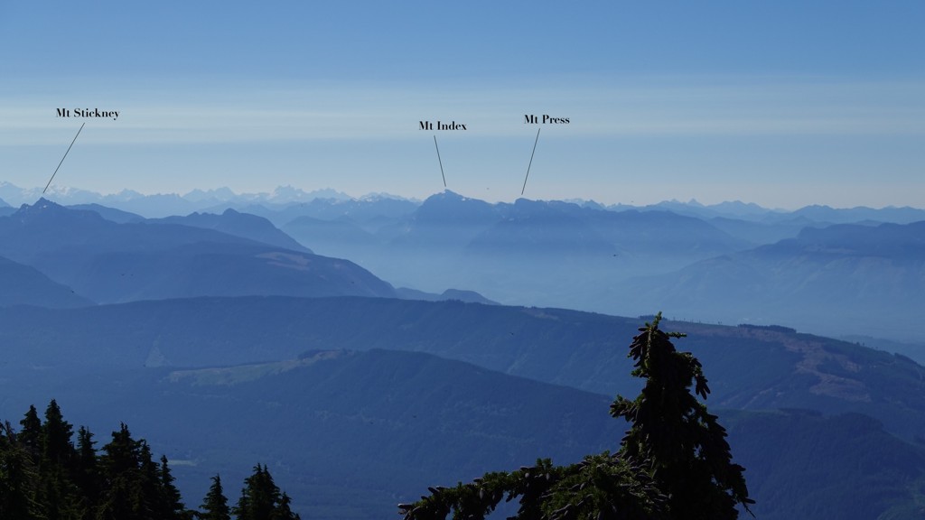
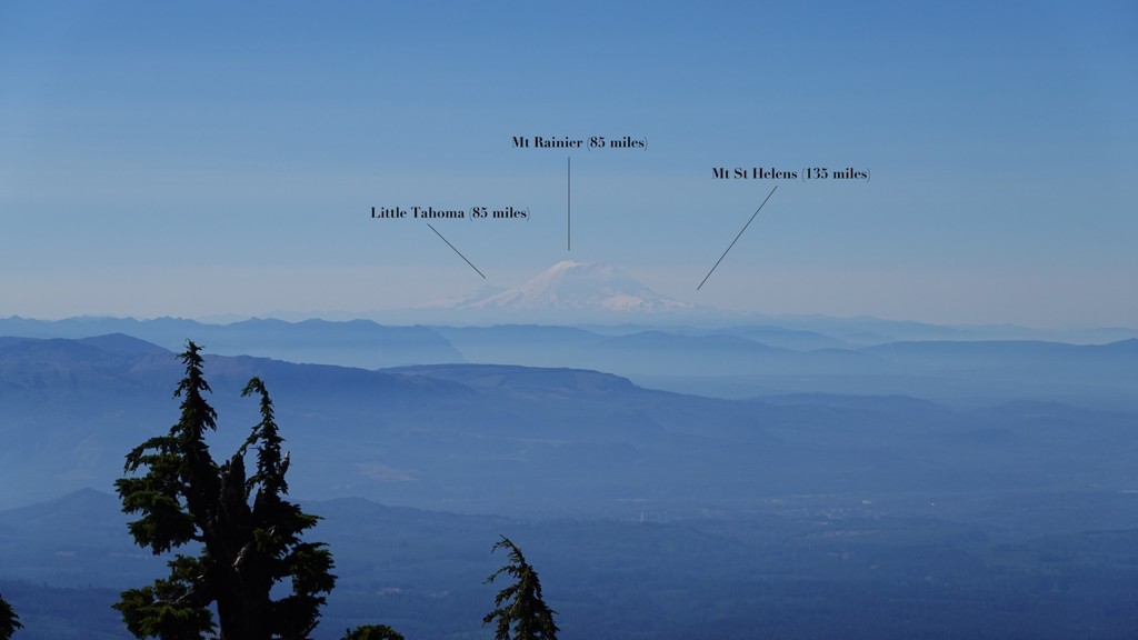
I took a handful of the photos from my hike from two days ago and annotated them to show the landmarks. I got pretty lucky: visibility was over 100 miles, give or take, and was a bit hazy in places due to suspected wildfire smoke.
For context, here are some of the distances of mountains and Puget Sound from the summit of Pilchuck:
- Puget Sound: 25 miles
- Glacier Peak: 32 miles
- Mt Baker: 50 miles
- Mt Shuksan: 54 miles
- Mt Rainier: 85 miles
- Mt Olympus (Olympic Mountains): 92 miles
- Mt St Helens: 135 miles
I'll begin with the view of Puget Sound (which is generally difficult to get in the Cascades unless you're on a mountain on the western edge, or you're up high enough and there are no other mountains obstructing your view), and walk around some of the most compelling views.
Note: all images are clickable for higher-rez versions.