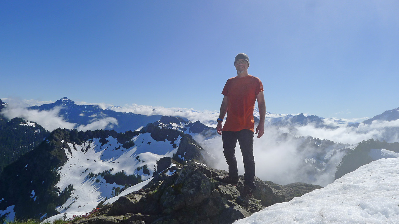
Yesterday, I took another mental health day and summited Mt Dickerson
There are a few things worth noting:
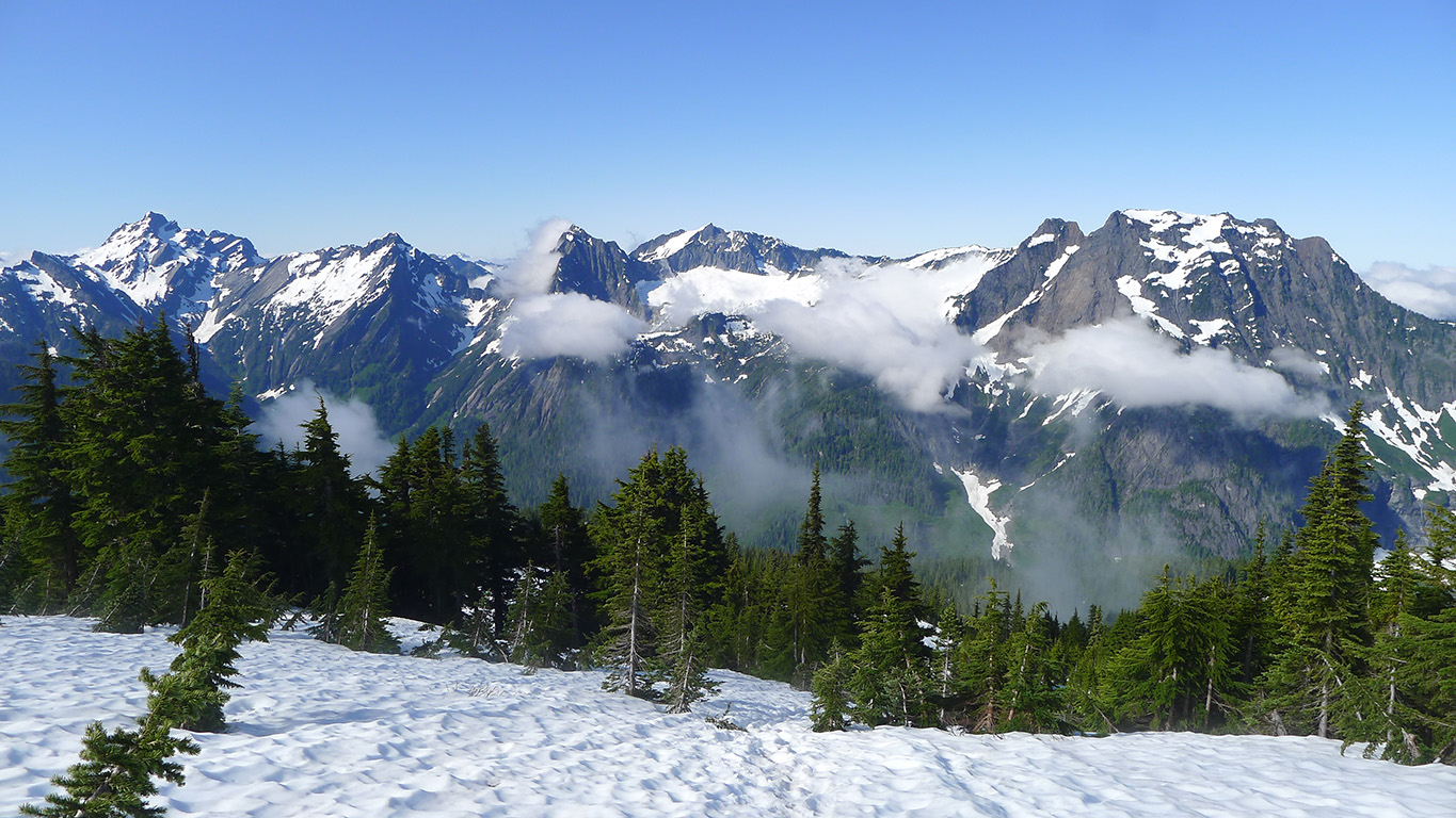
- This mountain is a WA State natural treasure. There are so very many mountain views of the Cascades at the top, it was breathtaking. I'm working on labelling some photos and will endeavor to post them at some point.
- I met a guy near the top, soon after I began my descent, who was hiking up. He was 68 years old and yesterday was his *fourth* time summiting the mountain *this year*. He said he uses that mountain to build endurance. I told him he was a total inspiration (he was/is).
- About 50 miles from my house, on the way to the hike, I realized I had forgotten my backpack. Since I didn't want to cancel my hike, I put two canvas grocery bags, one per shoulder, on my shoulders, and then bound their handles together with an abandoned dog leash I found in the parking lot (think "mule-pack style" if that helps). This was to prevent them from slipping off of my shoulders as I hiked. I balanced them out as best I could (and packed as absolutely little as possible). It worked pretty well, save for some excessive swinging at times. Other hikers were kind enough not to (a) point out my ridiculous "gear" and (b) make fun of me for it.
- I got really lost about 2.75 miles into the hike. I ended up at a dead end, near a ridge, in a snow field. I actually had given up ... reset my GPS to begin the descent down. Approx 1/8 of a mile later, I re-found the trail and was able to continue.
From the WTA site description:
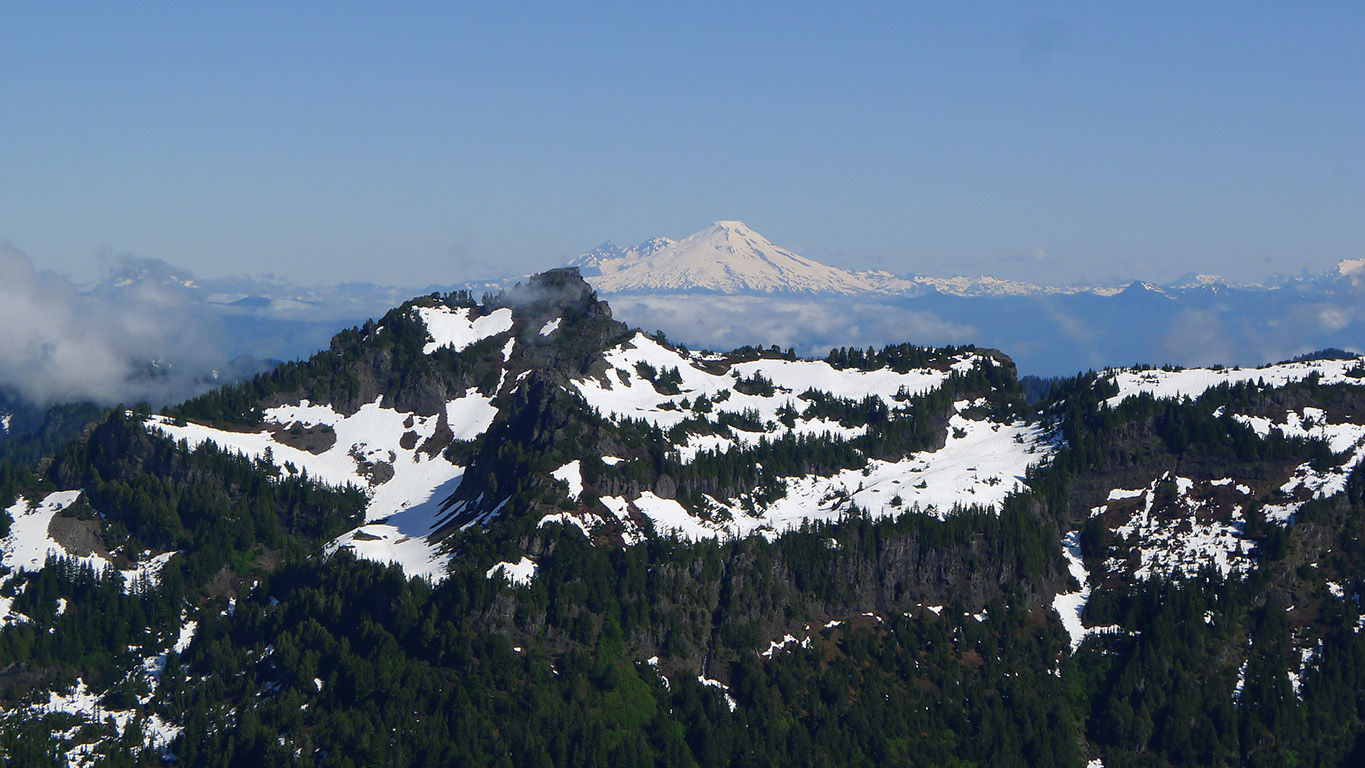
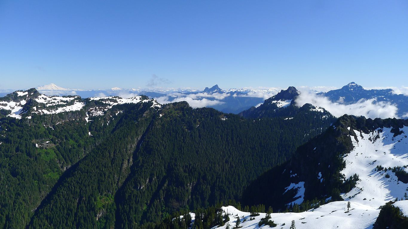
Can confirm. There's a stitched together south-facing view below that shows these peaks. The north-facing view is fantastic. It shows Mt Pugh, and Mt Baker. among many others.
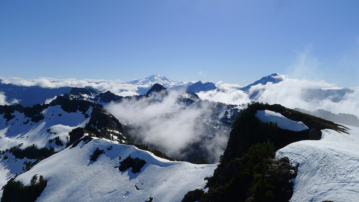
Here's a composite image (it's 5 images stitched together) with the major peaks labelled: Del Campo, Morningstar, Sperry, Vesper, and Big Four. Pilchuck is there - you can just barely see the tip of it behind the fog, to the right of Hail Peak:
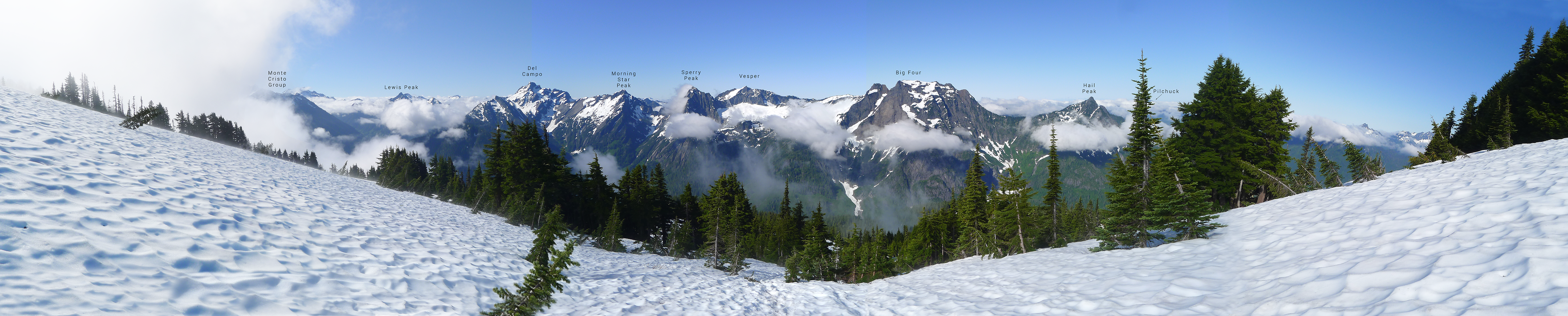
(You'll need to download that image to view it in it's entirety)
Here's a composite image (it's 5 images stitched together) with the major peaks labelled: Del Campo, Morningstar, Sperry, Vesper, and Big Four. Pilchuck is there - you can just barely see the tip of it behind the fog, to the right of Hail Peak:
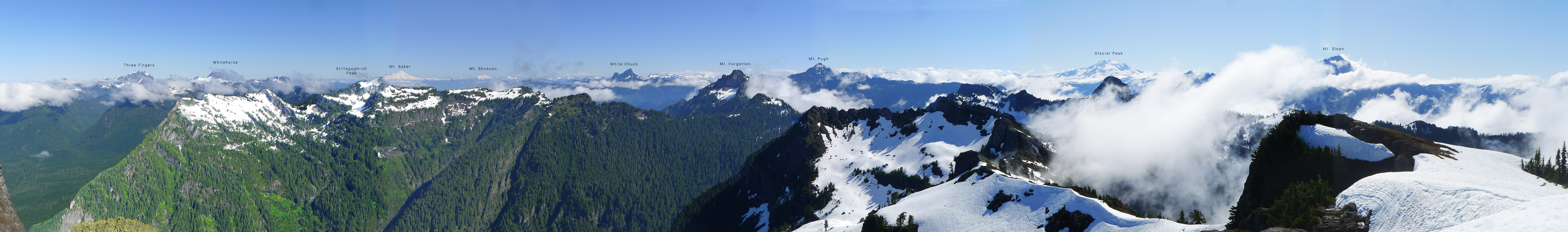
(You'll also need to download that image to view it in it's entirety)