The Summit of Vesper Peak Is Stunning and Unique
The summer hiking season here in the Northwest is very short this year. On one end, it started late because we got so much snow earlier this spring, therefore most every hike with any decent elevation was still underneath snow all the way through July. On the other end, I think everyone is [rightfully] expecting wildfire smoke in August, which will either (a) make some hikes inaccessible (due to actual wildfires closing off trailheads[1]) and/or (b) make it difficult to hike due to heavy smoke and (c) obscure any views from the summit.
For those of you keeping score, that's a window of July & August, at best.
To that end, these are my July & August hikes thus far:
(If we were playing "Mountain Loop Hiking Bingo", I think someone would have won already)
I managed to summit Vesper two days ago, and it was quite clear that the wildfire season is upon us. While I was in the valley between Morningstar and Sperry, some very thick white smoke settled in, and truth be told it was a bit concerning[2].
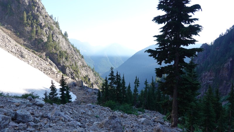
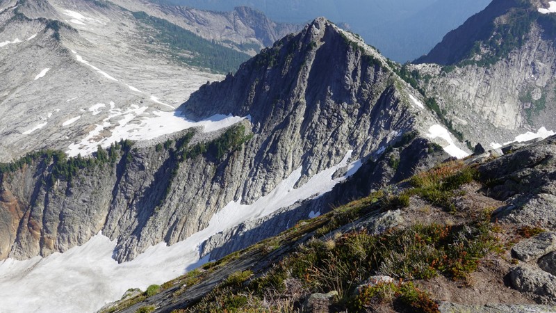
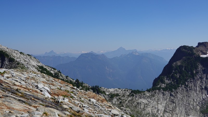
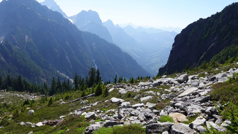
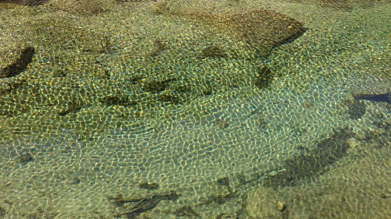
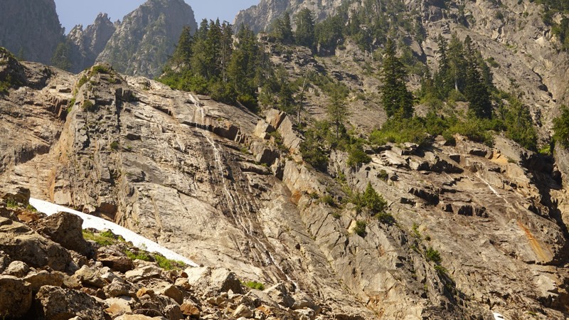
This is what I saw, looking north from near Headlee Pass:
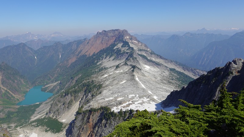
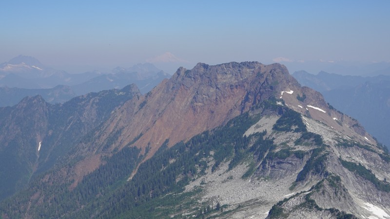
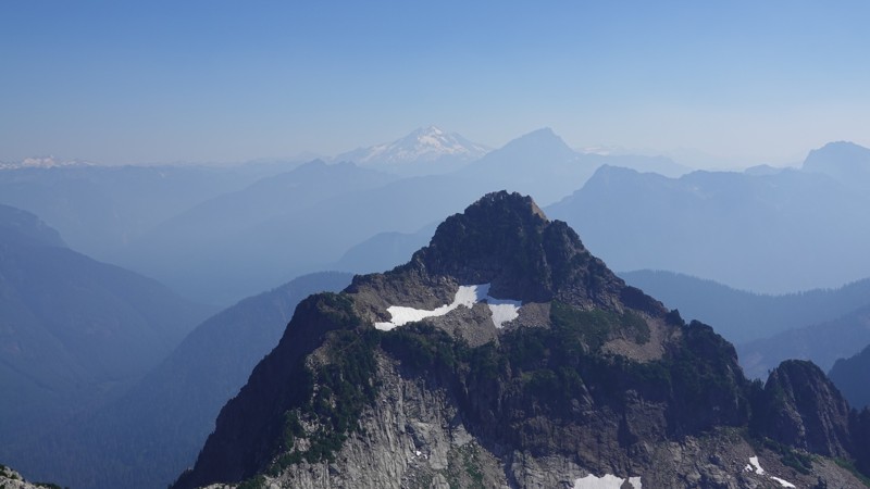
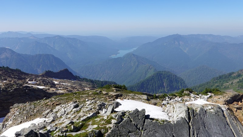
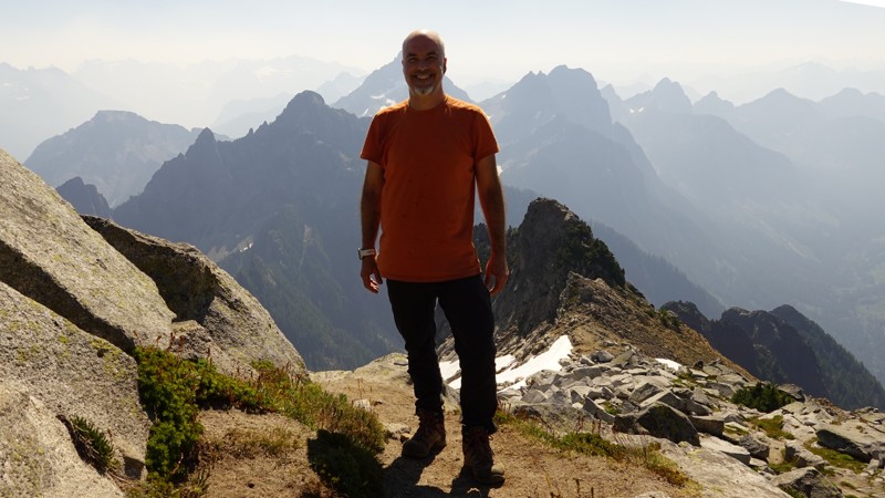
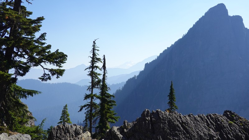
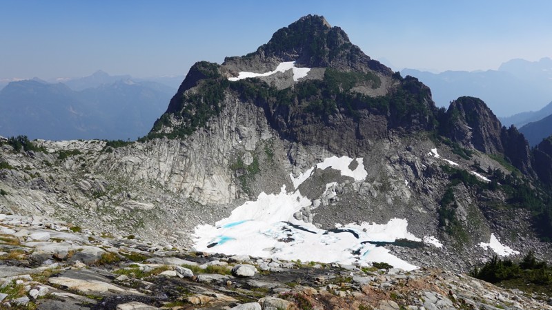
The view was partially obscured at the summit, but I could still see Mt Baker & Mt Shuskan (55 miles away, due north) and Mt Rainier (80 miles to the south), so that's not bad.
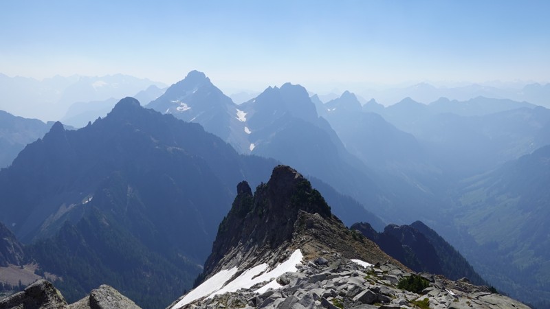
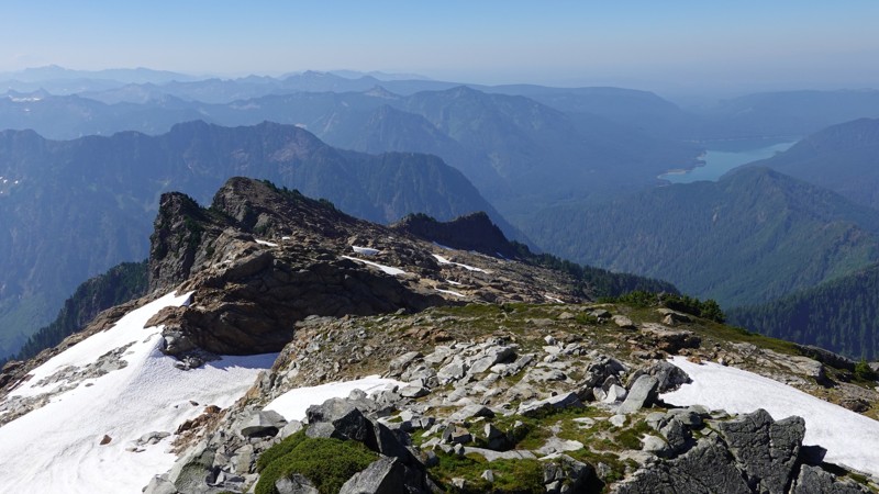
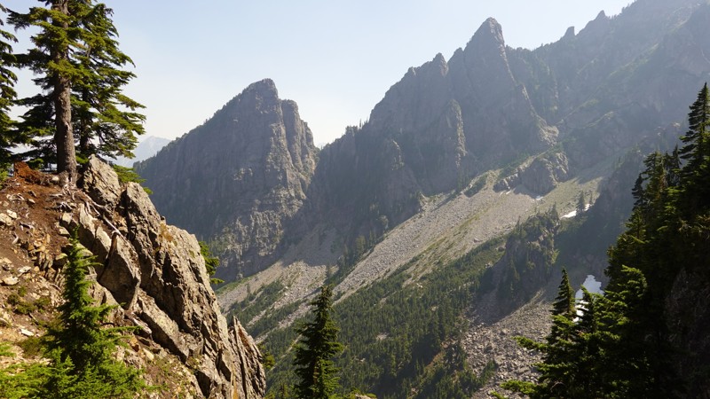
Vesper is amazing. It's part of the Gothic Group and includes Del Campo, Gothic Peak, Morningstar, Sperry Peak, and Vesper Peak (among others I'm sure). Nearby mountains are Big Four, Three Fingers, Whitehorse, Mt Baker, Whitechuck, and Mt Shuksan (N), Mt Pugh and Mt Forgotten (NE), Sloan and Glacier Peak (E), and the Monte Cristo Group, which includes thousands of peaks (SE).
It's a really special place to hike, and I think made even better if you've seen Vesper from other vantage points (you're staring it in the face from the summit of Del Campo). If you hike Gothic Basin or Foggy Lake, Vesper, Morningstar, and Sperry may as well not exist, as they're completely hidden by Del Campo.
Don't be fooled by my five hour hiking time. The "clock time" on that hike was about seven hours. Only 30 minutes of that difference can be accounted for by my time at the summit. I found Vesper to be a fairly difficult hike, and was happy that I made it to the summit by 11am, so I could begin my descent before noon and try to avoid the peak heat of afternoon.
To get to the summit of Vesper, there are three main segments of your journey:
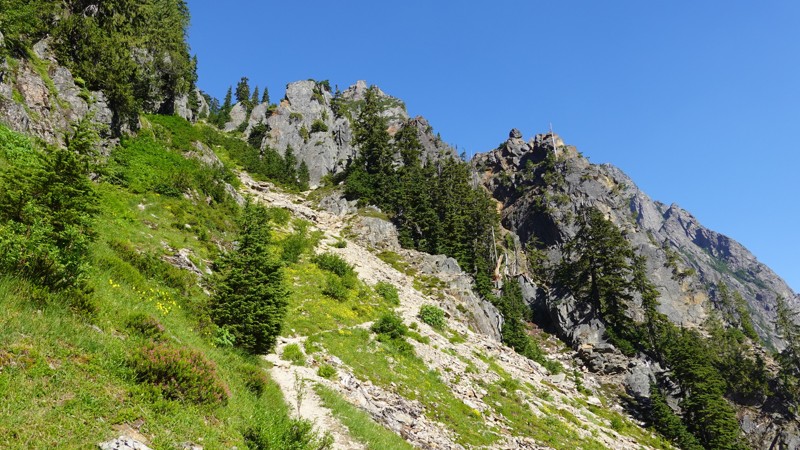
- The hike to Headlee Pass (pronounced "heed-ly"), which is in the valley between Morningstar and Sperry Peak.
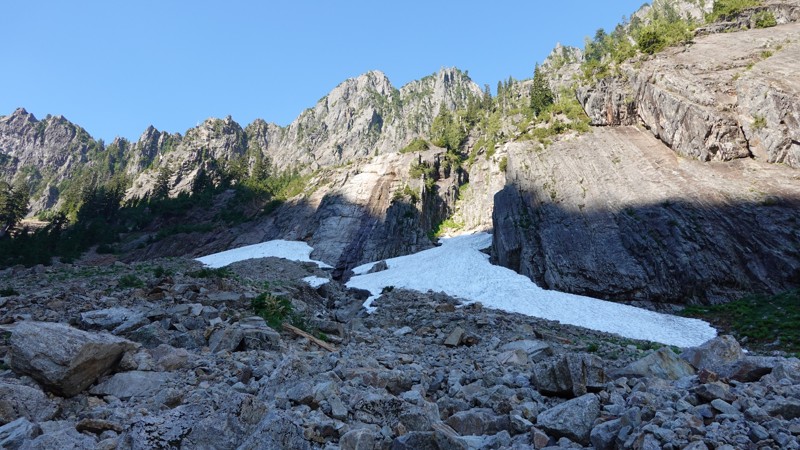
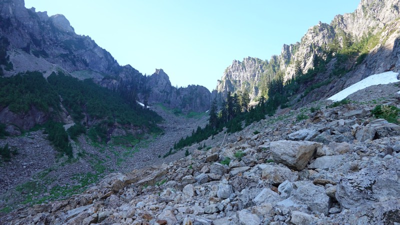
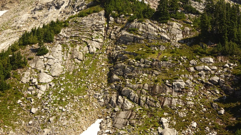
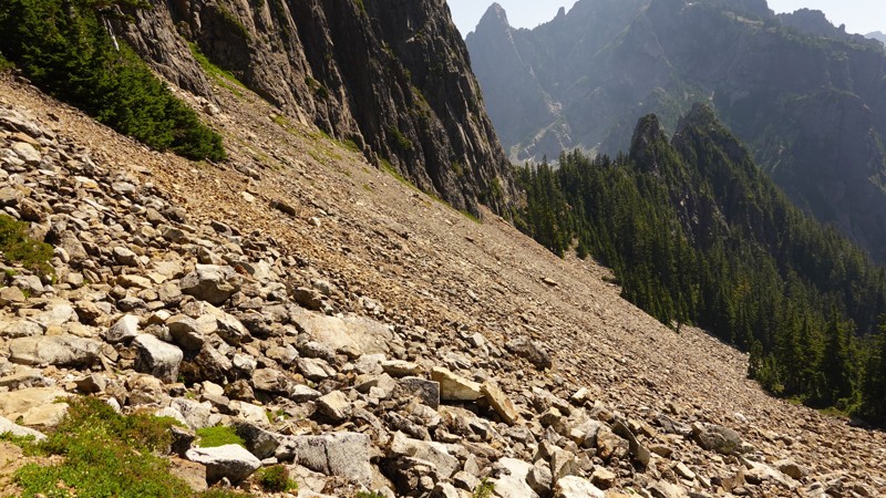
- Crossing a huge rock field adjacent to Sperry.
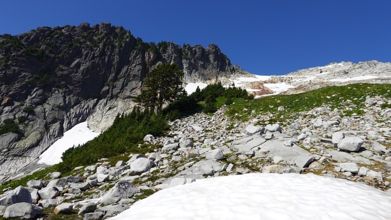
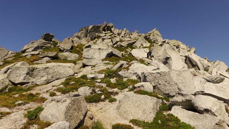
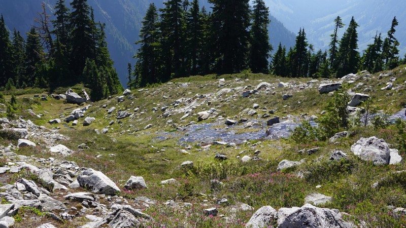
- A straight-line scramble to the summit, over a field of large, smooth stones.
What I really enjoyed about this one was that during the last segment, I did a lot of navigating by eye. Between the area around Vesper Lake and the summit, you don't need to follow a trail (and there really isn't one, so that checks out). You just look to where you want to end up and start walking/climbing.
You can get to the summit by simply looking up at it and deciding what your best route will be to get there.
(And similar for the initial part of your descent)
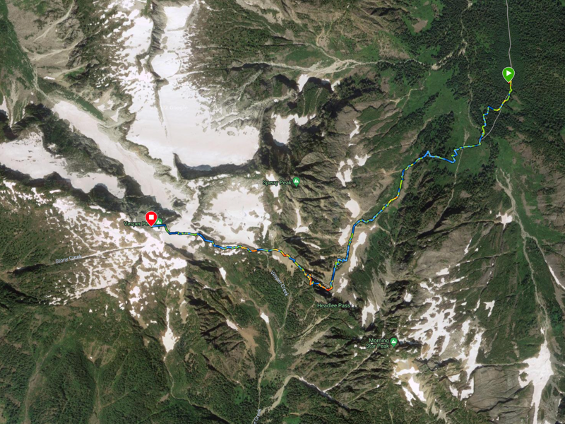
It's also worth noting that Avenza Maps has an amazing GPS map for this hike[3]. I've never seen a map so accurate .. it was precise.
Here is my ascent and descent. The descent is a little shorter because I paused my Garmin near the end during a break and then hiked for a bit before I remembered to start it back up.
Note: According to my Garmin, the temperature reached 97° during my descent. It felt that hot in the valley between Morningstar and Sperry, and as I met people making their was up the valley at ~1pm, I felt bad for them.
And here's my ascent map, courtesy of Garmin:
I'd like to break these down into two groups:
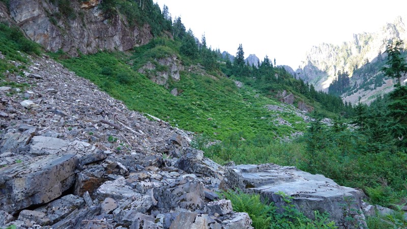
- The trail: which is super cool and had many photographable features.
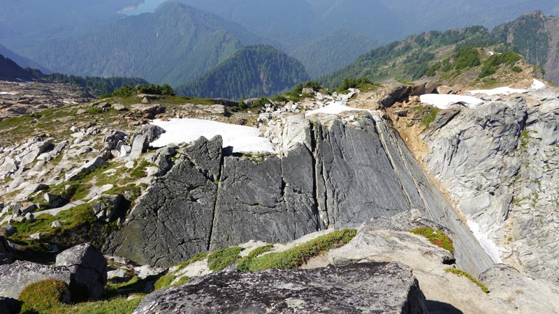
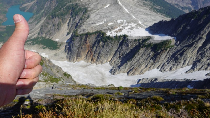
- The summit; which has very rad views that can only be seen from that local area.
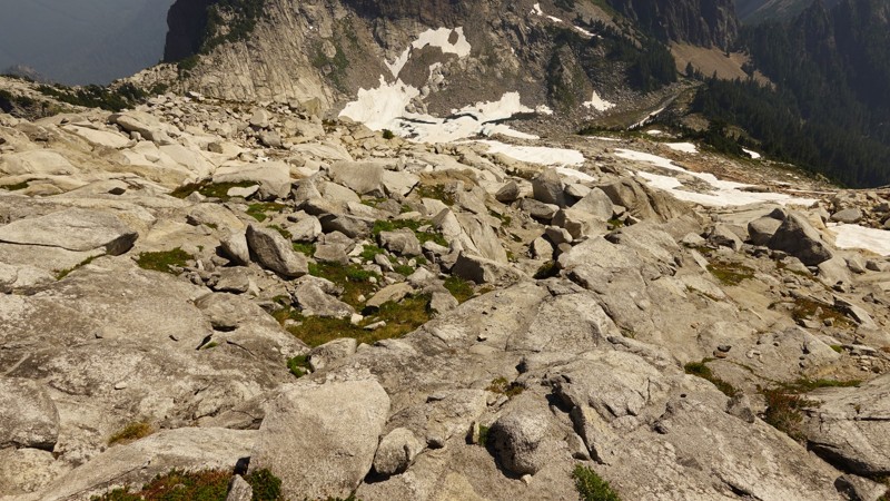
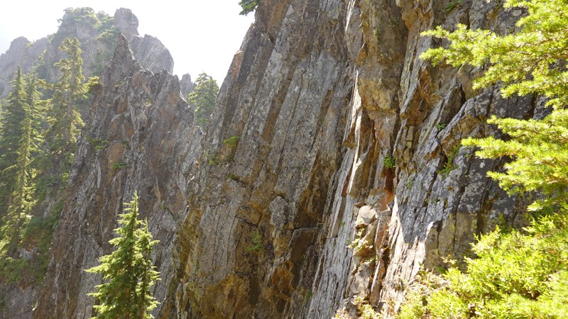
The trail is really interesting. It's highly variant, from talus slopes, to walking on loose rocks, to walking through Headlee Pass, across another rock field, and then a highly civilized section of dirt and grass prior to the summit. So I think it's worth capturing some of the trail in photos.
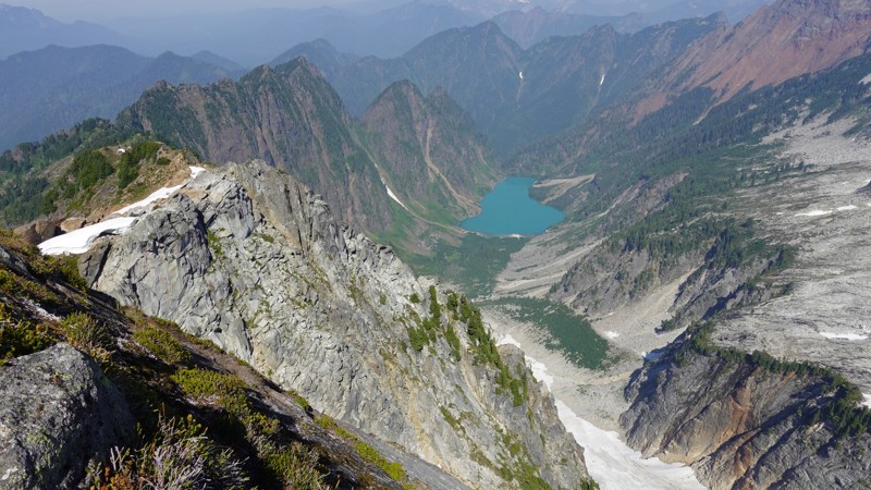
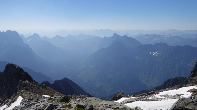
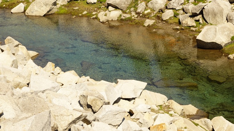
The views at the top are outstanding. The summit really is just a pile of rocks, adjacent to a massive 800' drop down along Vesper Glacier towards Copper lake. It's raw, and rugged, and beautiful.
Note: all images are clickable for higher-rez versions.

With Avenza, there's a little blue dot, showing your location, and an arrow,
showing which direction you're facing. And it's on a map, which shows the
trail. It's wonderfully simple, and I now use it on every hike.