This Is Not a Picture Of Me On a Trail Run Yesterday In King County
(Many trailheads are still closed in King County and I don't want to run afoul [literally and/or figuratively] of any mayoral and/or gubernatorial decrees)
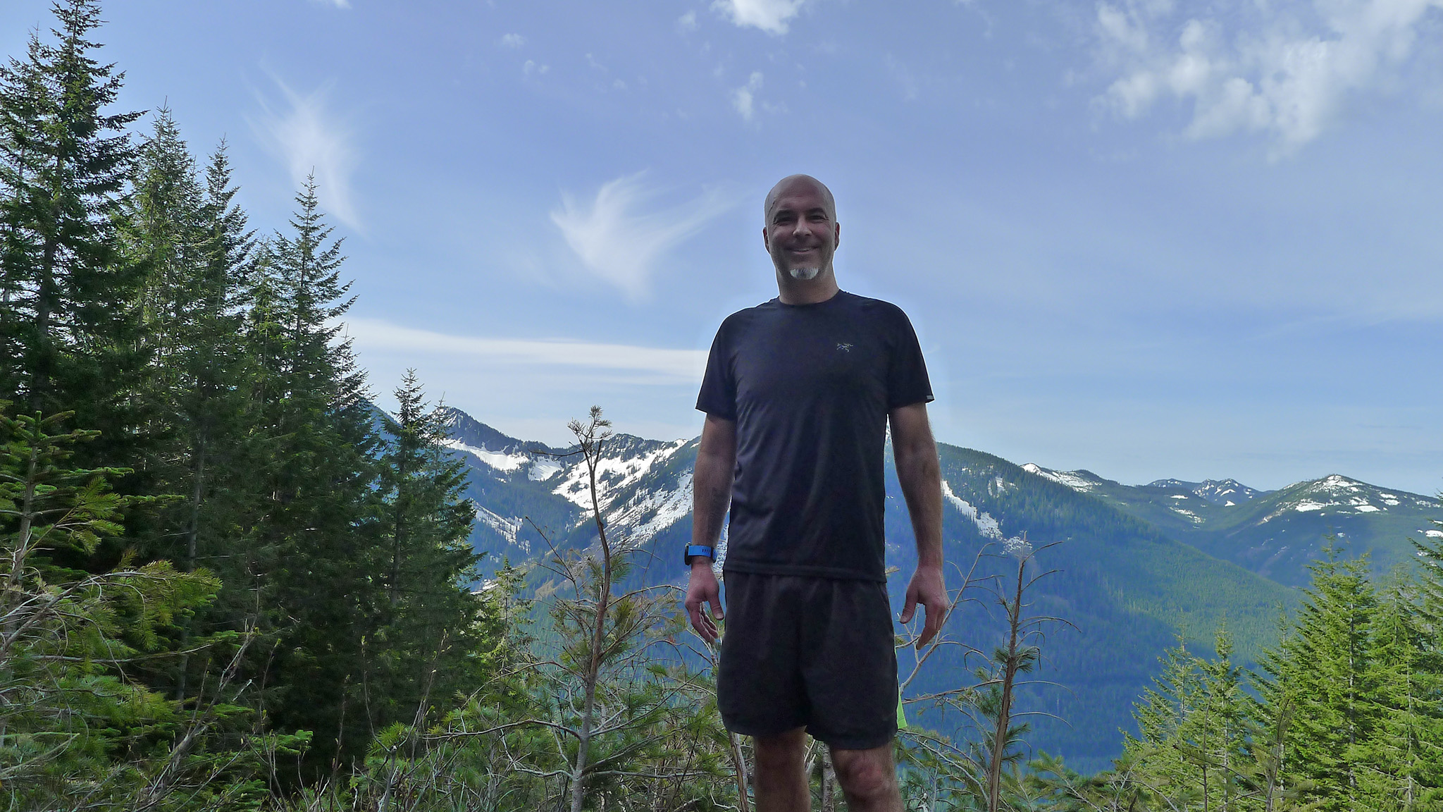
There must be something wrong with me because the elevation gain was 2,000 feet over just two miles .. so this one was just brutal. The wta.org review of this hike opens with the following: "The astounding views from the summit of the Granite Mountain trail come at a price. A nearly-1000-feet-of-elevation-gain-per-mile price. "
Can confirm.
Incidentally, the soundtrack to this run was compliments of Casual and Pep Love "It Gets No Better". ("Here it is, here it is, here it is it don't get no better").
(Alternate soundtrack: Kate Bush "Running Up That Hill")
Lately, I've been tempted to write to my legislative representative and try to persuade WA State lawmakers to add "nature" to the list of requisite mental health services.
Anyways, I started trail running in early January and have done nine of these since then (including two during the pandemic closures). It's been fascinating to run periodically in areas that have landslides and then, between two successive runs, come back to actual landslides that have happened. I've seen ~5 landslides on only three trails.
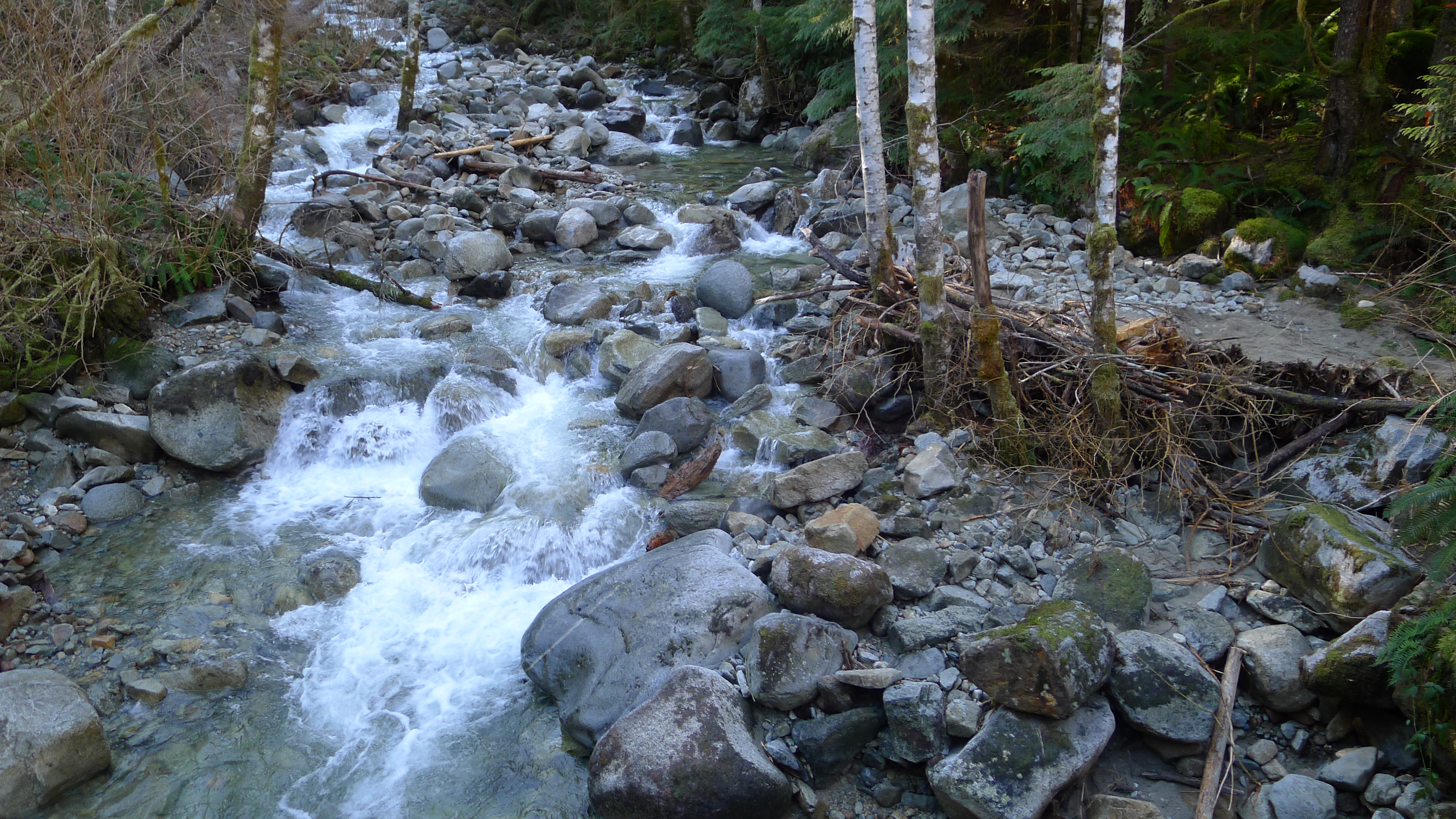
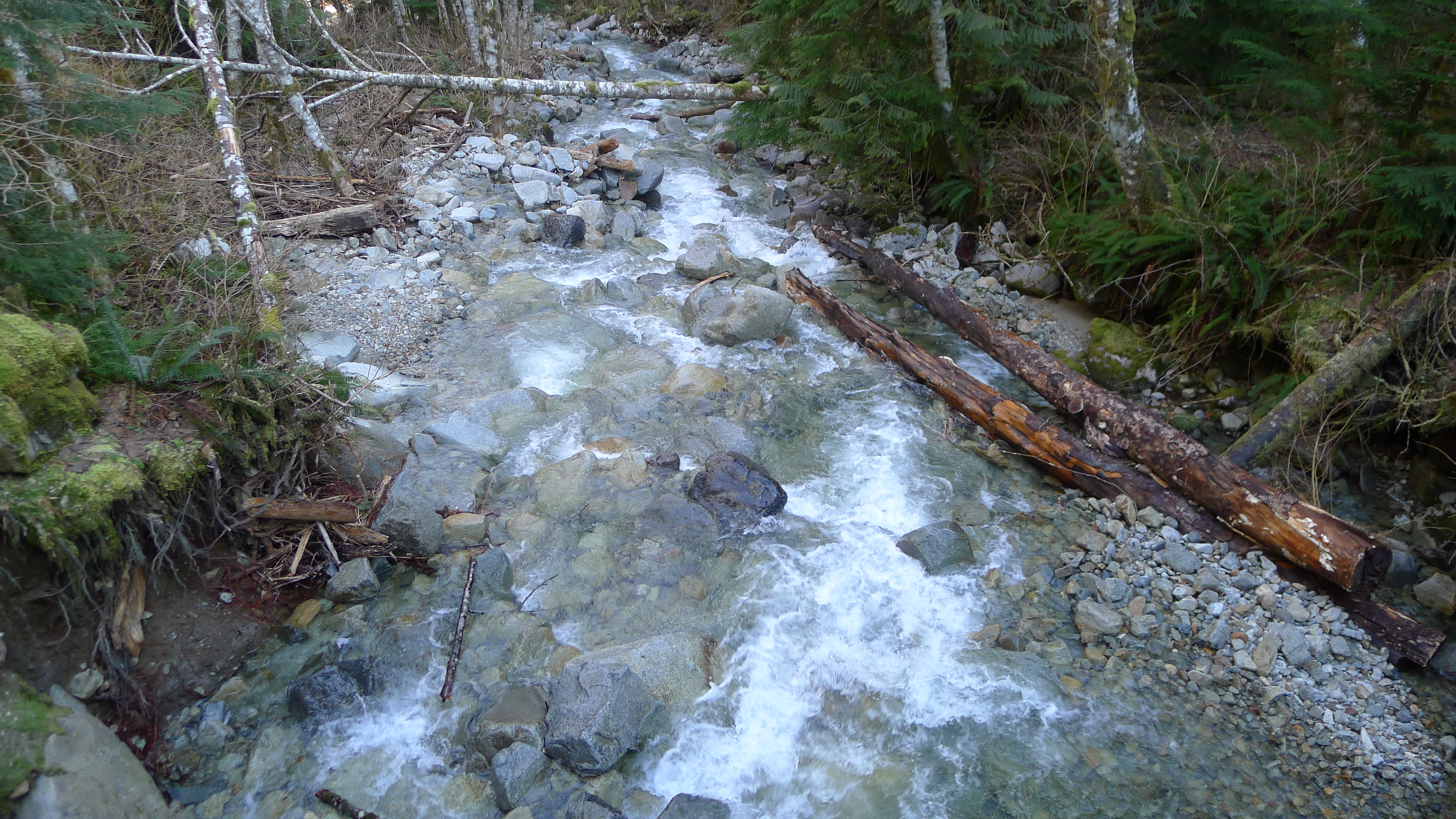
For example, here is a picture of granite creek during the non-rainy season:
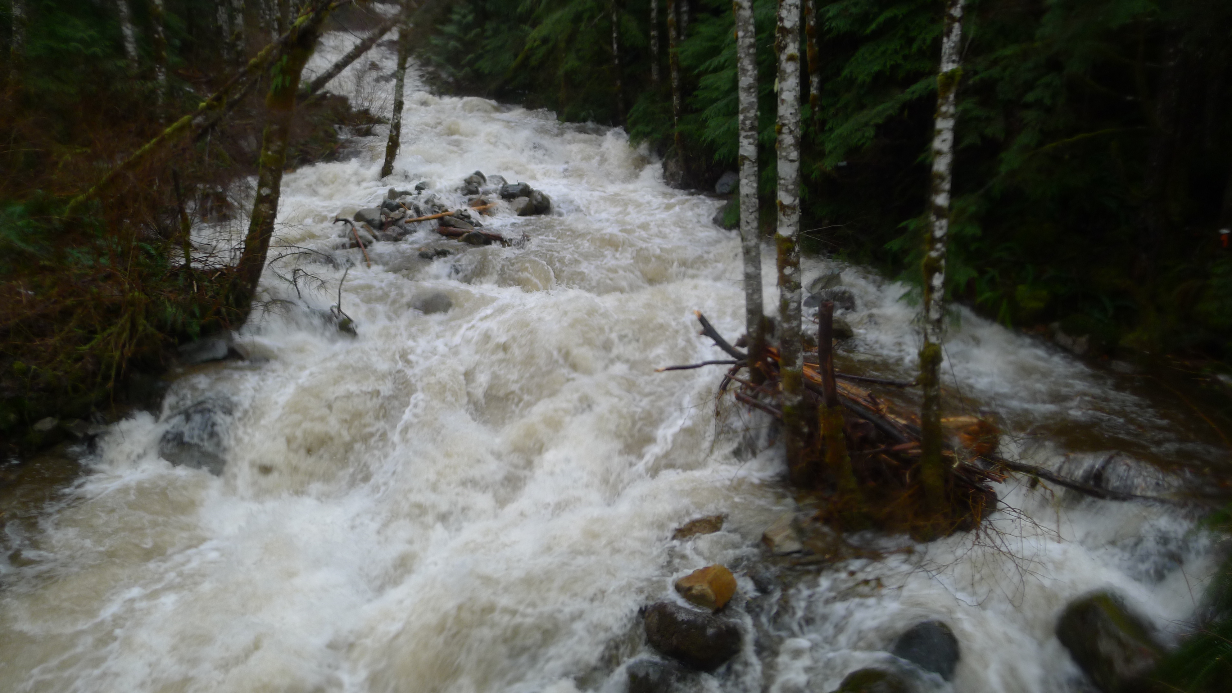
And here's the exact same photo form 2/7 of this year. Note the placement of the trees in the water on the left:
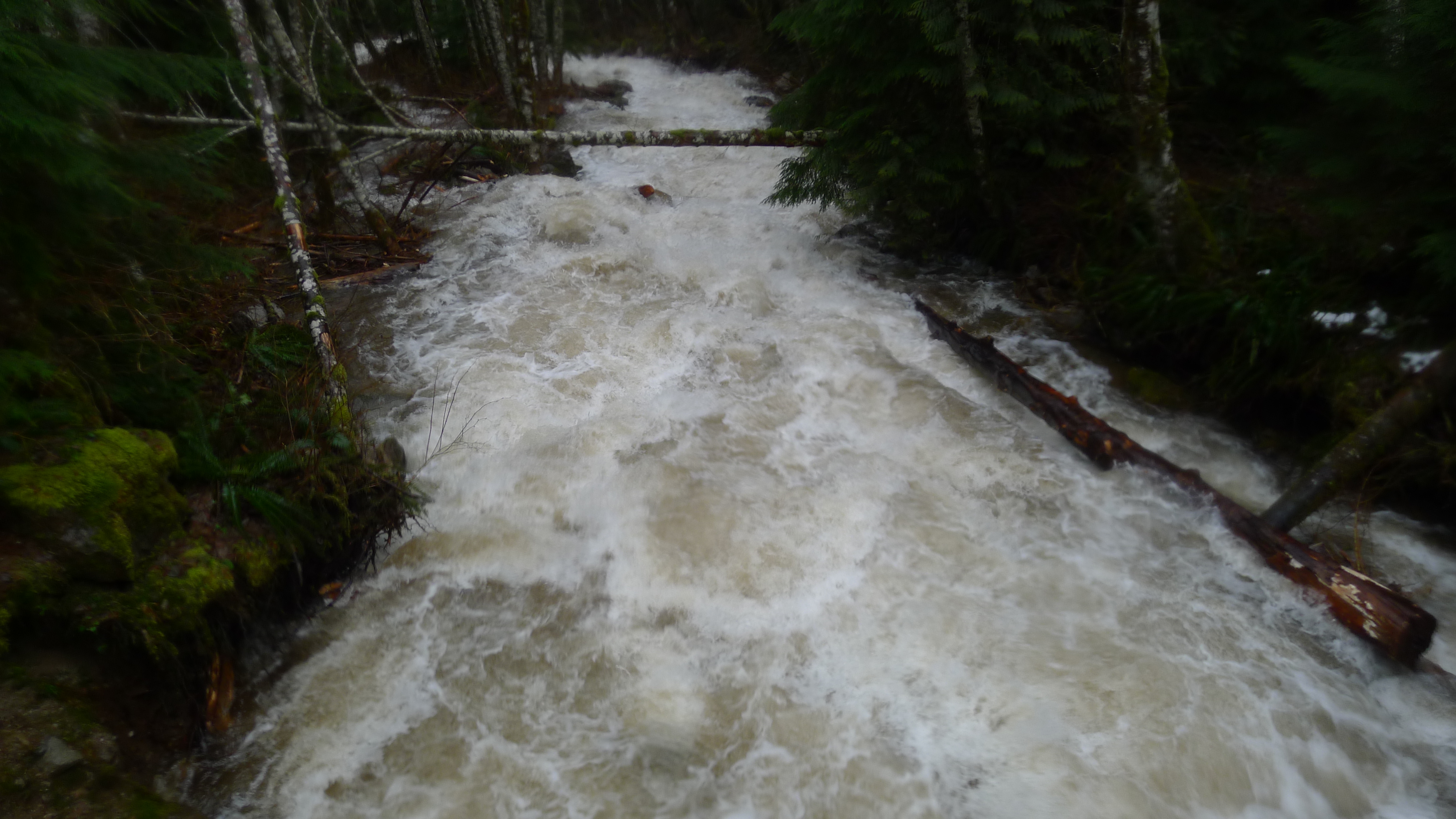
Non-rainy season:
Exact same photo, rainy-season. Note the placement of the logs in both photos... they're in the exact same place:
Anyways, it was fascinating to run and watch erosion happening in real time (running in a stream that was normally a dry trail). I have some amazing photos of some North Bend landslides that I stumbled upon. I'll endeavor to post them.
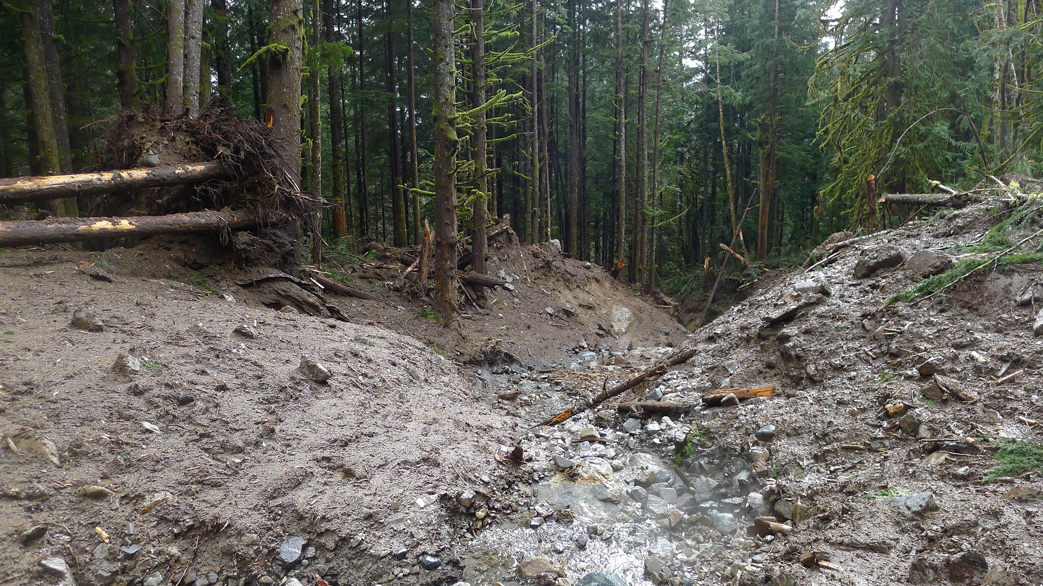
Here's another landslide I ran into [literally] in North Bend. Prior to the rain, this was a level, 3-foot-wide trail through the woods - it was very unremarkable - post landslide, there's a gully that's 60' wide and 20' deep .. and when i walked across it, my shoes sunk 12" into the mud.
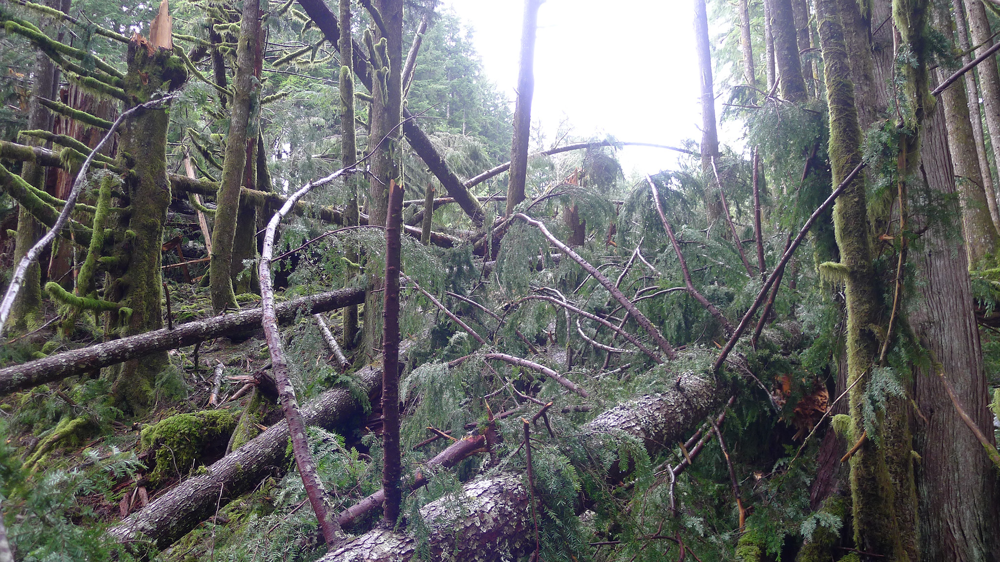
This is approaching it from the side:
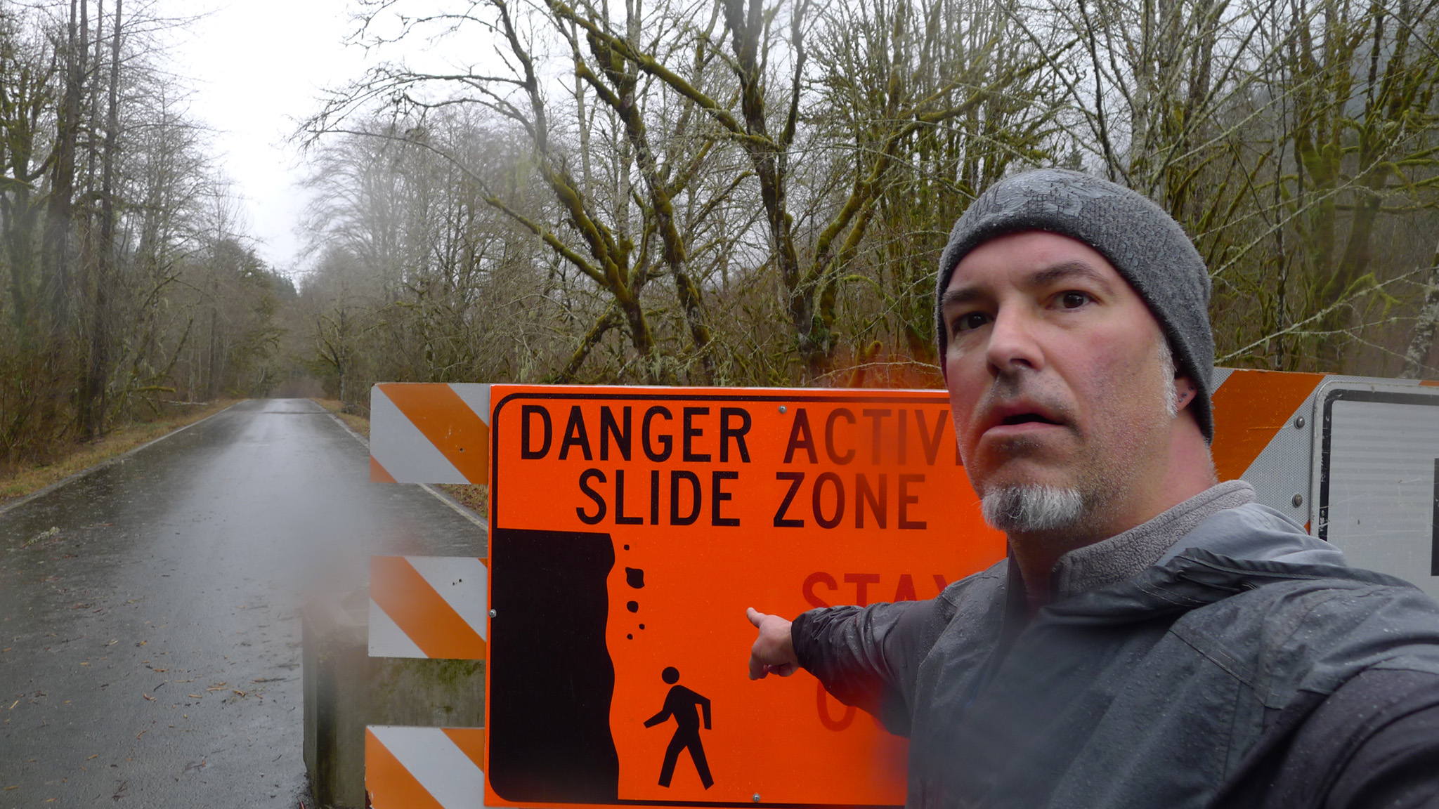
Remember kids, always obey the signs, or you could run into trouble with a North Bend Ranger who happens to park his truck in front of this sign, which means you'll have to walk right by him on your way out of this restricted area[1].